Maps of Netherlands

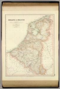
Holland & Belgium.
1 : 950400 Fullarton, A. & Co.

Holland and Belgium.
1 : 1330560 Colton, G.W.
XVII PROVINCIAE BELGII accurate delineatae
Belgie
Holland and Belgium.
1 : 1290000 Colton, G.W.
Neueste Karte von Holland, Belgien und Luxemburg
Grosser Hand-Atlas über alle Theile der Erde in 170 Karten Meyer, J. Verlag des Bibliographischen Instituts
Das Königreich der Niederlande, das Königreich Belgien und das Groszherzogthum Luxemburg
1 : 950000 entworfen und gezeichnet von C.F. Weiland. Weimar : im Verlage des Geogr. Instituts
The Kingdom of the Netherlands
1 : 1495000 Belgie Walker, C. Baldwin & Gradock
Das Königreich der Niederlande. Das Königreich Belgien und das Grossherzogthum Luxemburg

Niederlande, Belgien.
1 : 1470000 Flemming, Carl
Holland And Belgium.
1 : 1187000 Johnson, A.J.
44. Belgio e Olanda.
1 : 1500000 Touring club italiano
Belgique, Hollande, Limbourg, Luxembourg.
1 : 1000000 Picquet, C.
Holland and Belgium.
1 : 1300000 Colton, G.W.
Pays-Bas et Belgique.
1 : 1180000 Migeon, J.

Hollande, Belgique.
1 : 1070000 Andriveau-Goujon, J.
Belgium, Netherlands.
1 : 1140480 Letts, Son & Co.
Nieuwe kaart van het Koningrijk der Nederlanden en het Groot-Hertogdom Luxemburg, benevens geheel België : verdeeld in provincien volgens de jongste bepalingen, verrijkt met de post & andere groote wegen
1 : 1000000 zamengest. & gegraveerd door W.C. van Baarsel. Te Zalt-Bommel : bij Joh. Noman en Zoon
Belgique et de Hollande, 1812.
1 : 3500000 Malte-Brun, Conrad, 1775-1826
Pays-Bas.
1 : 1000000 Brue, Adrien Hubert, 1786-1832
Niederlande Und Belgien.
1 : 1110000 Vogel, C.
Holland and Belgium.
1 : 4000000 Colton, G.W.
Netherlands.
1 : 1237000 Teesdale, Henry
Niederlande, Belgien, Luxemburg
Hand-Atlas über alle Theile der Erde nach dem neuesten Zustande und über das Weltgebäude Stieler, Adolf bei Justus Perthes
Carte du Royaume des Pays-Bas.
1 : 1360000 Vivien de St Martin, L.
[Niederlande, Belgien, Luxemburg]
Hand-Atlas über alle Theile der Erde nach dem neuesten Zustande und über das Weltgebäude Stieler, Adolf bei Justus Perthes
Netherlands, Belgium.
1 : 1170000 Society for the Diffusion of Useful Knowledge (Great Britain)
Nieuwe kaart van het Koningrijk der Nederlanden en het Groot-Hertogdom Luxemburg : met aanwijzing der nieuwe postwegen = Nouvelle carte du Royaume des Pays-Bas et du Grand-Duché de Luxembourg : avec les routes de poste / dressé et gravé par C. van Baarsel et Fils
1 : 580000 Baarsel, C. van La Haye : F.J. Weygand