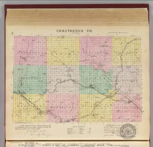
Maps of Chautauqua County

Chautauqua Co., Kansas.
1 : 126720 L.H. Everts & Co.
Sedan
1 : 125000
Sedan
1 : 125000
Sedan
1 : 125000
Sedan
1 : 125000
Sedan
1 : 125000
Cedar Vale East
1 : 24000
Cedar Vale East
1 : 24000
Cedar Vale East
1 : 24000
Elgin
1 : 24000
Elgin
1 : 24000
Elgin
1 : 24000
Chautauqua
1 : 24000
Peru
1 : 24000
Peru
1 : 24000
Chautauqua
1 : 24000
Cloverdale
1 : 24000
Cloverdale
1 : 24000
Elgin NE
1 : 24000
Elgin NE
1 : 24000
Sedan
1 : 24000
Sedan
1 : 24000
Hale
1 : 24000
Sedan
1 : 24000
Hale
1 : 24000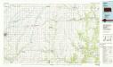
Sedan
1 : 100000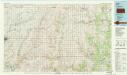
Sedan
1 : 100000
Grenola
1 : 24000
Grenola
1 : 24000
Moline
1 : 24000
Moline
1 : 24000
Elk Falls
1 : 24000
Oak Valley
1 : 24000
Oak Valley
1 : 24000