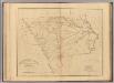
Maps of Chesterfield County
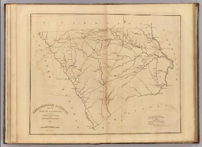
Chesterfield District, South Carolina.
1 : 126720 Mills, Robert
Bethune
1 : 24000
Bethune NW
1 : 24000
Lake Robinson
1 : 24000
Lake Robinson
1 : 24000
Hartsville North
1 : 24000
Dovesville
1 : 24000
Cash
1 : 24000
Middendorf
1 : 24000
Patrick
1 : 24000
Angelus
1 : 24000
Mount Pisgah
1 : 24000
Mount Pisgah
1 : 24000
Cheraw
1 : 24000
Jefferson
1 : 24000
Jefferson NE
1 : 24000
Jefferson NE
1 : 24000
Ruby
1 : 24000
Chesterfield
1 : 24000
Mont Clare
1 : 24000
Society Hill
1 : 24000
Wallace
1 : 24000
Wallace
1 : 24000
Lancaster
1 : 100000
Lancaster
1 : 100000
Rockingham
1 : 125000
Morven East
1 : 24000
Pageland
1 : 24000
Pageland
1 : 24000
Hornsboro
1 : 24000
Hornsboro
1 : 24000
Morven West
1 : 24000
Morven West
1 : 24000
Morven East
1 : 24000