Maps of Rocky Mountains
Western Canada.
1 : 5955840 Johnston, W. & A.K.
West-Canada und Britisch Columbia
Adolf Stieler's Handatlas über alle Theile der Erde und über das Weltgebäude Stieler, Adolf Justus Perthes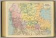
British Columbia, North West Territory.
1 : 5274720 Stanford, Edward
Map of the Missouri; of the higher parts of the Mississippi.
1 : 8500000 Tardieu, P.F.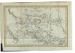
Charte von Mackenzie's Reisen von Montreal zu dem nördlichen Eis- und dem stillen Meere
1 : 18500000 Landes-Industrie-Comptoir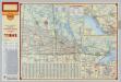
Shell Manitoba - Saskatchewan. Alaska Highway. Calgary. Edmonton.
1 : 3041280 Shell Oil Company
191-192. Canada, West. The World Atlas.
1 : 5000000 USSR (Union of Soviet Socialist Republics).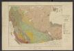
Atlas of Canada. No. 4, Geology, west sheet
1 : 6336000 Canada. Ministère de l'intérieur [Ottawa] : Canada, Department of the Interior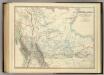
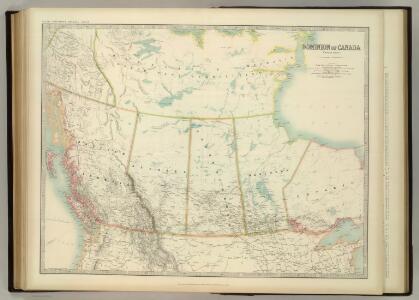
Western Canada.
1 : 5955840 Johnston, Alexander Keith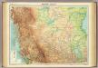
Western Canada.
1 : 5000000 John Bartholomew and Son
Facsimile: Devine's Northwest Part of Canada (portion).
1 : 9000000 Devine, Thos.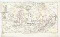
Canada
Kanada Dathe, C. Gleditsch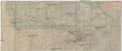
Canada's Grand Trunk Eisenbahnsystem
1 : 7500000 Kanada
A Map Of The United States Of Mexico.
1 : 5195520 Tanner, Henry S.
Facsimile: Pinkerton's British Possessions in North America (portion).
1 : 8200000 Pinkerton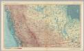
Canada - British Columbia, and Prairie Provinces. Pergamon World Atlas.
1 : 5000000 Polish Army Topography Service
Wind and current chart of the North-Pacific
1 : 4000000 Maury, Matthew Fontaine [United States Hydrographical Office]
Facsimile: Western Coast of America (portion).
1 : 5600000 Alaskan Boundary Tribunal
Facsimile: Part of Map of British North America. Arrowsmith.
1 : 9750000 Arrowsmith, John
Facsimile: Map of the Province of British Columbia.
1 : 4539000 Mohun, Edward
Limits of forest trees
1 : 12500000 Kanada
Alberta. British Columbia.
Rand McNally and Company
British Columbia
1 : 2450000
A map of Mackenzie's track from Fort Chipewyan to the Pacific Ocean in 1793
1 : 1850000
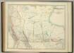
Oregon Territory.
1 : 7200000 Greenleaf, Jeremiah
Oregon Territory.
1 : 7603200 Greenleaf, Jeremiah
Oregon Territory.
1 : 6969600 Burr, David H., 1803-1875
Vereinigte Staate(n v. Nordamerika) I.
1 : 8000000 Berghaus, Heinrich; Flemming, Carl; Sohr, Karl
General Map of the North Pacific States and Territories.
1 : 2700000 Mullan, John