Maps of New York

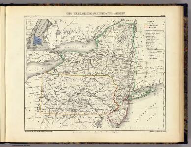
Neu York, Pennsylvanien u. Neu Jersey.
1 : 3400000 Lange, Henry, 1821-1893.
Plan of The State of New York.
from Atlas of Steuben County, New York : from actual surveys and official records / compiled & published by D.G. Beers & Co.
Map of New Jersey and Pennsylvania : exhibiting the post offices, post roads, canals, rail roads, &c. / by David H. Burr (late topographer to the Post Office), geographer to the House of Representatives of the U.S.
from Parts
Northern or Middle States.
1 : 3000000 Cornell, S. S. (Sarah S.)
Map of the state of New York with part of Upper Canada / engraved & printed by Fenner Sears & Co.
from Whole
Lines and Metallic Circuit Connections.
1 : 2534400 American Telephone and Telegraph Company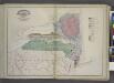
Geological Map
from New topographical atlas and gazetteer of New York, comprising a topographical view of the several counties of the state, ... including ... map of the United States and territories ... Compiled from the latest astronomical observations, official surveys and records of the United States and territories ...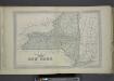
Plan of The State of New York.
from County atlas of Orange, New York / from actual surveys by and under the direction of F.W. Beers.
A map of the province of Pensilvania / drawn from the best authorities, by T. Kitchin, gr.
from John H. Levine Collection
Map shewing the rail roads between Lake Erie, New York & Boston : intended to illustrate the importance of the N. York & Erie Rail Road / J.F. Smith, del.
from Whole
Carte des Provines Septles. des Etats-Unis.
1 : 2400000 Marshall, John
Map of the state of New York : compiled from the latest authorities.
from Whole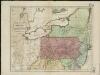
Map of the middle states of America, comprehends New-York, New-Jersey, Pennsylvania, Delaware, and the territory N.W. of Ohio
Russell, John Symonds, Henry Delahoy
New York.
1 : 3674880 Scott, Joseph
Shell Sectional Map No. 2 - North Atlantic States.
1 : 1457280 Shell Oil Company
New York / by H.S. Tanner ; engraved ... by H.S. Tanner.
from Whole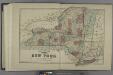
Plan of the State of New York.
from Atlas of Madison County, New York : from actual surveys / by and under the direction of D. G. Beers.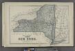
Plan of the State of New York.
from County atlas of Cayuga, New York. From recent and actual surveys and records under the superintendence of F. W. Beers.
Map of the State of New York / J.H. Young.
from Whole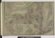
Oswego ; Buffalo ; Rochester ; Syracuse ; New York ; Albany ; Troy ; Vicinity of New York
from Atlas of Montgomery and Fulton counties, New York. From actual surveys / by and under the direction of B. Nichols ; assisted by H.B. Stranahan ... [et al.]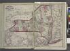
Railroads of the state.
from New topographical atlas and gazetteer of New York, comprising a topographical view of the several counties of the state, ... including ... map of the United States and territories ... Compiled from the latest astronomical observations, official surveys and records of the United States and territories ...
Map of the state of New York : compiled from the latest authorities.
from Whole
Map of the state of New York : compiled from the latest authorities.
from Whole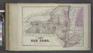
Plan of the State of New York.
from Atlas of Columbia County, New York. From actual surveys and official records. Compiled & published by D. G. Beers & Co.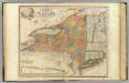
New-York State, surrounding country.
1 : 1300000 Burr, David H., 1803-1875
La Pensilvania, la Nuova York, il Jersey Settentrio[na]le: con la parte occidentale del Connecticut, Massachusset-s-bay e l'Irochesia.
from Parts A. (Antonio) Zatta:[Venezia],
Middle States.
1 : 3600000 Huntington, Nathaniel G. (Nathaniel Gilbert), 1785-1848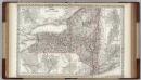
New York.
1 : 1250000 Colton, G.W.
Massachusetts, Rhode Island, and Connecticut. New York.
1 : 1000000 Schonberg & Co.