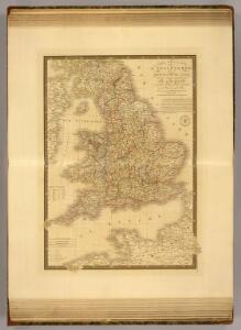
Maps of England

Angleterre, Galles.
1 : 1700000 Picquet, C.
Angleterre, Galles.
1 : 1700000 Brue, Adrien Hubert, 1786-1832
Carte du royaume d'Angleterre
1 Karte : Kupferdruck ; 75 x 51 cm Hérisson; Basset; Basset chez Basset rue St. Jacques no. 670
Le royaume d'Angleterre
1 Karte auf 2 Blättern : Kupferdruck ; 74 x 57 cm Sanson; Jaillot chez H. Iaillot
delineation of the strata of England and Wales, with part of Scotland
Übersichtskarte Smith, William Cary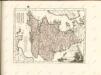

47-48. Inghilterra, Galles.
1 : 1500000 Touring club italiano
Britannia Antiqua.
1 : 2800000 Horsley, John, 1675-1732
England and Wales.
1 : 1450000 Johnson, A.J.
England, Wales.
1 : 4000000 Seaman, James V.
England, Wales.
1 : 2800000 Arrowsmith, Aaron; Lewis, Samuel
The post roads thorough England and Wales
1 Karte : Kupferdruck ; 55 x 47 cm Jefferys; Faden printed for Jefferys and Faden Corner of St Martin's Lane Charing Cross
The roads of England and Wales.
1 : 2400000 Moll, Herman, d. 1732
England and Wales.
1 : 1450000 Johnson, A.J.
England and Wales.
1 : 1450000 Johnson, A.J.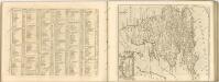

England and wales.
1 : 13000000 Colton, G.W.
Regni Angliae et principatus Cambriae tabula nova
1 Karte : Kupferdruck ; 57 x 51 cm Kitchin; Rausch Homännische Erben
Anglia II. Nova Tabula [Karte], in: Geographia universalis vetus et nova complectens Claudii Ptolemaei Alexandrini enarrationis libros VIII, S. 305.
1 Karte aus Atlas Münster, Sebastian [und Ptolemaeus, Claudius]
Angleterre.
1 : 1700000 Levasseur, E.
Spezialkarte von dem Königreiche England
1 Karte : Kupferdruck ; 20 x 27 cm Reilly F. J. J. von Reilly
England and Wales.
1 : 2800000 Finley, Anthony
Angleterre.
1 : 1855000 Migeon, J.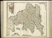
[86][86] Anglia Regnum ..., uit: Atlas sive Descriptio terrarum orbis
Annotatie: Gedigitaliseerde versie. Amsterdam. Heiloo : Picturae (vervaardiger), 2015. tiff-bestand. Gedigitaliseerd: 07-01-2015; Origineel: Universiteitsbibliotheek Vrije Universiteit (XL.05127.-) ; Netherlands; Titelpagina ontbreekt Wit, Frederik de Amsterdam : Frederick de Wit
Ordnance survey physical map of Englad and Wales
1 : 1071000 Anglie Ordnance Survey Office
Composite: England and Wales.
1 : 887000 Johnston, W. & A.K.
Angleterre.
1 : 2780000 Malte-Brun, Conrad, 1775-1826
Composite: England, Wales.
1 : 575000 Robert Laurie & James Whittle