Maps of Wandsworth

Maps of Wandsworth

$title$

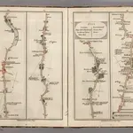
Newington to Ryegate.

1 : 63360 Cary, John
$title$

Surrey VII.12 (includes: Mitcham; Wandsworth Borough) - 25 Inch Map

1 : 2500 Topographic maps Ordnance Survey Ordnance Survey
$title$

Surrey VII.12 (includes: Mitcham; Wandsworth Borough) - 25 Inch Map

1 : 2500 Topographic maps Ordnance Survey Ordnance Survey
$title$

London (1915- Numbered sheets) XII.4 (includes: Mitcham; Wandsworth Borough; Wimbledon St Mary) - 25 Inch Map

1 : 2500 Topographic maps Ordnance Survey Ordnance Survey
$title$

London (Edition of 1894-96) CXXXIV (includes: Mitcham; Wandsworth Borough; Wimbledon St Mary) - 25 Inch Map

1 : 2500 Topographic maps Ordnance Survey Ordnance Survey
$title$

London (1915- Numbered sheets) VIII.16 (includes: Battersea; Wandsworth Borough; Wimbledon St Mary) - 25 Inch Map

1 : 2500 Topographic maps Ordnance Survey Ordnance Survey
$title$

London (Edition of 1894-96) CXXIV (includes: Battersea; Wandsworth Borough; Wimbledon St Mary) - 25 Inch Map

1 : 2500 Topographic maps Ordnance Survey Ordnance Survey
$title$

London (First Editions c1850s) LXXXIII (includes: Battersea; Wandsworth Borough; Wimbledon St Mary) - 25 Inch Map

1 : 2500 Topographic maps Ordnance Survey Ordnance Survey
$title$

London (1915- Numbered sheets) VIII.12 (includes: Battersea; Wandsworth Borough) - 25 Inch Map

1 : 2500 Topographic maps Ordnance Survey Ordnance Survey
$title$

London (Edition of 1894-96) CXIV (includes: Battersea; Wandsworth Borough) - 25 Inch Map

1 : 2500 Topographic maps Ordnance Survey Ordnance Survey
$title$

London X.50 - OS London Town Plan

1 : 1056 Topographic maps Ordnance Survey Ordnance Survey
$title$

London X.60 - OS London Town Plan

1 : 1056 Topographic maps Ordnance Survey Ordnance Survey
$title$

London X.70 - OS London Town Plan

1 : 1056 Topographic maps Ordnance Survey Ordnance Survey
$title$

London X.80 - OS London Town Plan

1 : 1056 Topographic maps Ordnance Survey Ordnance Survey
$title$

London X.90 - OS London Town Plan

1 : 1056 Topographic maps Ordnance Survey Ordnance Survey
$title$

London XI.41 - OS London Town Plan

1 : 1056 Topographic maps Ordnance Survey Ordnance Survey
$title$

London X.100 - OS London Town Plan

1 : 1056 Topographic maps Ordnance Survey Ordnance Survey
$title$

London XI.51 - OS London Town Plan

1 : 1056 Topographic maps Ordnance Survey Ordnance Survey
$title$

London XIV.10 - OS London Town Plan

1 : 1056 Topographic maps Ordnance Survey Ordnance Survey
$title$

London XI.61 - OS London Town Plan

1 : 1056 Topographic maps Ordnance Survey Ordnance Survey
$title$

London XIV.20 - OS London Town Plan

1 : 1056 Topographic maps Ordnance Survey Ordnance Survey
$title$

London XI.71 - OS London Town Plan

1 : 1056 Topographic maps Ordnance Survey Ordnance Survey
$title$

London XIV.30 - OS London Town Plan

1 : 1056 Topographic maps Ordnance Survey Ordnance Survey
$title$

London XI.81 - OS London Town Plan

1 : 1056 Topographic maps Ordnance Survey Ordnance Survey
$title$

London XI.91 - OS London Town Plan

1 : 1056 Topographic maps Ordnance Survey Ordnance Survey
$title$

London XV.1 - OS London Town Plan

1 : 1056 Topographic maps Ordnance Survey Ordnance Survey
$title$

London XV.11 - OS London Town Plan

1 : 1056 Topographic maps Ordnance Survey Ordnance Survey
$title$

London XV.21 - OS London Town Plan

1 : 1056 Topographic maps Ordnance Survey Ordnance Survey
$title$

Insurance Plan of London South West District Vol. K: sheet 19

1 : 480 This detailed 1903 plan of London is one of a series of twelve sheets in an atlas originally produced to aid insurance companies in assessing fire risks. The building footprints, their use (commercial, residential, educational, etc.), the number of floors and the height of the building, as well as construction materials (and thus risk of burning) and special fire hazards (chemicals, kilns, ovens) were documented in order to estimate premiums. Names of individual businesses, property lines, and addresses were also often recorded. Together these maps provide a rich historical shapshot of the commercial activity and urban landscape of towns and cities at the time. The British Library holds a comprehensive collection of fire insurance plans produced by the London-based firm Charles E. Goad Ltd. dating back to 1885. These plans were made for most important towns and cities of the British Isles at the scales of 1:480 (1 inch to 40 feet), as well as many foreign towns at 1:600 (1 inch to 50 feet). Chas E Goad Limited Chas E Goad Limited
$title$

Insurance Plan of London South West District Vol. K: sheet 20

1 : 480 This detailed 1903 plan of London is one of a series of twelve sheets in an atlas originally produced to aid insurance companies in assessing fire risks. The building footprints, their use (commercial, residential, educational, etc.), the number of floors and the height of the building, as well as construction materials (and thus risk of burning) and special fire hazards (chemicals, kilns, ovens) were documented in order to estimate premiums. Names of individual businesses, property lines, and addresses were also often recorded. Together these maps provide a rich historical shapshot of the commercial activity and urban landscape of towns and cities at the time. The British Library holds a comprehensive collection of fire insurance plans produced by the London-based firm Charles E. Goad Ltd. dating back to 1885. These plans were made for most important towns and cities of the British Isles at the scales of 1:480 (1 inch to 40 feet), as well as many foreign towns at 1:600 (1 inch to 50 feet). Chas E Goad Limited Chas E Goad Limited
© MapTiler © OpenStreetMap contributors
How does it work?
These instructions will show you how to find historical maps online.
Getting started
Type the place name in the search box to find the exact location. You can further adjust the search by zooming in and out.
Zoom
Zoom in and out with the buttons or use your mouse or touchpad natively.
Exact Area tool
Click here and draw a rectangle over the map to precisely define the search area.
Set filters
Narrow your search with advanced settings, such as Years (from/to), Fulltext, Publisher, etc.
Results
See the results of your search on the right side. You can scroll down to find more maps of this location.
?

Download OldMapsOnline Mobile