Maps of Boone County

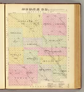
Boone Co.
1 : 126720 Everts & Kirk
Cedar Rapids
1 : 24000
Cedar Rapids
1 : 24000
Cedar Rapids
1 : 24000
Cedar Rapids SE
1 : 24000
Albion East
1 : 24000
Albion East
1 : 24000
Akron
1 : 24000
Akron
1 : 24000
Akron
1 : 24000
Albion West
1 : 24000
Albion West
1 : 24000
Elgin SW
1 : 24000
Elgin SW
1 : 24000
Petersburg
1 : 24000
Closter SW
1 : 24000
Closter SW
1 : 24000
Newman Grove
1 : 24000
Newman Grove
1 : 24000
Closter SE
1 : 24000
Closter SE
1 : 24000
Elgin NW
1 : 24000
Elgin NW
1 : 24000
Elgin NW
1 : 24000
Elgin
1 : 24000
Elgin
1 : 24000
Closter
1 : 24000
Closter
1 : 24000
Spalding SE
1 : 24000
Spalding SE
1 : 24000