Maps of Malay Archipelago
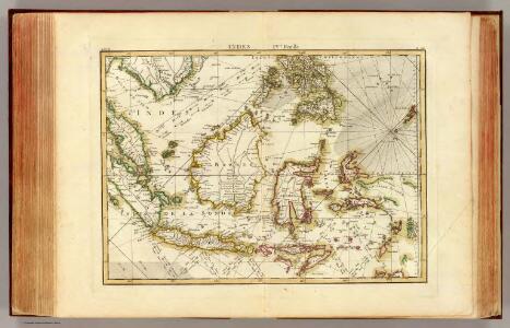
Indes IV.
1 : 10000000 Bonne, Rigobert, 1727-1794
The archipelago of the East, being the Sunda, the Molucca, and Phillipps. Islands, he chief settlements of the Dutch in India are in the Sunda and Molucca Islands
1 : 15500000
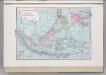
128-129. Indonesia. The World Atlas.
1 : 7500000 USSR (Union of Soviet Socialist Republics).
Die Ostindischen Inseln.
1 : 11500000 Stulpnagel, F.v.
Kaart van den Nederlandsch-Indischen Archipel / bewerkt door C.M. Kan
[Amsterdam : J.L. Beijers]
Die Ostindischen Inseln
Hand-Atlas über alle Theile der Erde und über das Weltgebäude Stieler, Adolf Justus Perthes
Kaart van den Oost Indischen Archipel. Verzamelingsblad
Grav. en druk v. T. Hooiberg te Leiden te 's Hage : uitgave van K. Fuhri
Ostindischen Inseln.
1 : 11000000 Berghaus, Heinrich; Flemming, Carl; Sohr, Karl
Indian Archipelago.
1 : 9187200 Fullarton, A. & Co.
Algemeene kaart van Nederlands Oostindie : op de schaal van 1:5.000.000 ontworpen naar de beste kaarten en bronnen / geteekend door W. Beyerinck, J.M. Bruyn en J.F.W.A. Essers, Kadetten bestemd voor de dienst in de Oostindiën ; gelithographeerd by de Koninklijke Militaire Akademie door F.J. Ensink
[Den Haag : Ministerie van Koloniën]
Malay Archipelago.
1 : 11000000 Society for the Diffusion of Useful Knowledge (Great Britain)
Die Ostindischen Inseln
Stieler's Hand-Atlas Stieler, Adolf bei Justus Perthes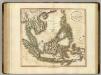
East India Isles.
1 : 8700000 Cary, John, ca. 1754-1835
Overzichtskaart van den Nederlandsch Oost Indischen Archipel / [J.W. Stemfoort en J.J. ten Siethoff ; gereproduceerd op last van het Departement van Koloniën, aan de Topographische Inrichting te 's-Gravenhage, onder leiding van den Directeur C.A. Eckstein]
Ministerie van Koloniën Den Haag s-Gravenhage : Departement van Koloniën
East India Islands.
1 : 16500000 Darton, William
Die Ostindischen Inseln
Hand-Atlas über alle Theile der Erde nach dem neuesten Zustande und über das Weltgebäude Stieler, Adolf bei Justus Perthes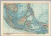
South-East Asia. Pergamon World Atlas.
1 : 10000000 Polish Army Topography Service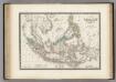
Malaisie.
1 : 1200000 Levasseur, E.
East India Islands.
1 : 10000000 Hall, S. (Sidney)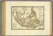
Grand Archipel d'Asie.
1 : 10200000 Brue, Adrien Hubert, 1786-1832
East India Islands.
1 : 34000000 Fenner, Rest.
East Indies.
1 : 12672000 Colton, G.W.
Dutch Possessions, in the Indian Archipelago.
1 : 13305600 Fullarton, A. & Co.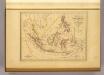
Malaisie.
1 : 18500000 Malte-Brun, Conrad, 1775-1826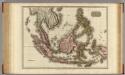
East India Isles.
1 : 7200000 Pinkerton, John, 1758-1826
East Indies.
1 : 11000000 Colton, G.W.
East Indies.
1 : 11000000 Colton, G.W.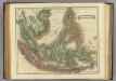
E. India Islands.
1 : 9000000 Lizars, Daniel