Maps of Northern European Plain
Europe 2.
1 : 2800000 Anville, Jean Baptiste Bourguignon d, 1697-1782
Europe (north)
1 : 6000000 Lizars, Daniel
Europe divided into its empires, kingdoms, states, republics, &c. (Northern States)
1 : 4800000 Kitchin, Thomas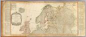
Europe (north)
1 : 4800000 Robert Laurie & James Whittle
Septentrionales Regiones XVIII. No. Tab. [Karte], in: Claud. Ptolemaeus. Geographia lat. cum mappis [...], S. 410.
1 Karte aus Atlas Münster, Sebastian [und Ptolemaeus, Claudius]
Swedland and Norway.
from A new systeme of the mathematicks: containing I. Arithmetick, as well natural and decimal, as in species, or the principles of algebra. II. Practical geometry, together with the first six books of Euclid's Elements, as also the eleventh and twelfth, symbo
Scandinavien und Polen, kirchlichen Eintheilung bis zur Reformation.
1 : 9400000 Spruner von Merz, Karl
Finnland und Skandinavien
1 : 4000000 Finsko Velhagen & Klasing
Septentrionalivm regionvm descrip
1 : 11050000 Evropa severozápadní
Schonlandia XIII Nova Tabula [Karte], in: Claud. Ptolemaeus. Geographia lat. cum mappis [...], S. 389.
1 Karte aus Atlas Münster, Sebastian [und Ptolemaeus, Claudius]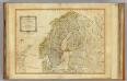
Northern States.
1 : 4400000 Robert Laurie & James Whittle
Kaart van Noorwegen, Denemarken, ijsland, Zweden, Finland, Engeland en de Noordzee / W. Seghers
1 : 4000000 Seghers, W. Antwerpen : Patria [etc.]
Spannungen in Nordeuropa
1 : 5000000 Evropa severní List & von Bressensdorf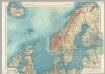
Northern Europe. Pergamon World Atlas.
1 : 5000000 Polish Army Topography Service
Schonlandia XIII Nova Tabula [Karte], in: Geographia universalis vetus et nova complectens Claudii Ptolemaei Alexandrini enarrationis libros VIII, S. 335.
1 Karte aus Atlas Münster, Sebastian [und Ptolemaeus, Claudius]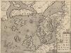
Septentrionallium Regionum Descrip. [Karte], in: Theatrum orbis terrarum, S. 381.
1 Karte aus Atlas Ortelius, Abraham Vrients, Jan Baptista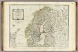
A new map of the Northern States containing the Kingdoms of Sweden, Denmark, and Norway.
1 : 4400000 Kitchin, Thomas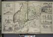
A new map of Denmark and Sweden. ...
from The world described, or, A new and correct sett of maps : shewing the kingdoms and states in all the known parts of the earth, with the principal cities, and most considerable towns in the world ... / ... by Herman Moll, geographer ...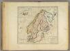
Sweden, Denmark, Norway and Finland.
1 : 6600000 Carey, Mathew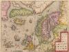
Septentrionalium Regionum Descrip. [Karte], in: Theatrum orbis terrarum, S. 286.
1 Karte aus Atlas Ortelius, Abraham
Dänemark, Island u Färöer, Schweden und Norwegen
Hand-Atlas über alle Theile der Erde nach dem neuesten Zustande und über das Weltgebäude Stieler, Adolf bei Justus Perthes
Dänemark, Jsland u. Färöer, Schweden und Norwegen
Stieler's Hand-Atlas Stieler, Adolf bei Justus Perthes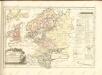

Schweden, Norwegen, Daenemark.
1 : 4000000 Ziegler, J. M.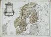
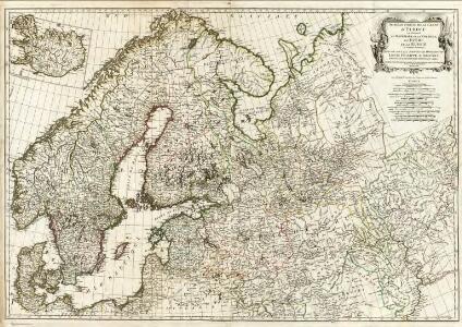
Les couronnes du Nord comprenant les royaumes de Suede Danemarck et Norwege
1 Karte : Kupferdruck ; 46 x 64 cm Janvier; Lattré; Choffard chés Lattré graveur rue Saint Jacques au coin de celle de la parcheminerie à la ville de Bordeaux
Sweden, Denmark, Norway, and Finland from the Best Authorities.
1 : 6550000 Melish, John
Scandinavia.
1 : 9300000 Bowen, Emanuel
Karte von Europa, 1
4 Blätter : 53 x 70 cm Verlag der Königlich-Preussischen Academie-Kunst- und Buchhandlung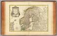
Suede, Danemarck et Norwege.
1 : 6900000 Janvier, Jean