Maps of Metropolitan France

Europe 1.
1 : 2800000 Anville, Jean Baptiste Bourguignon d, 1697-1782
West-Europa
1 : 3000000 Evropa západní Georg Westermann
Carte de la Germanie et les diferents etats ou ses peuples ont porté leurs conquestes
Evropa jižní Chatelain, Henri-Abraham Chatelain
Western Europe - communications.
1 : 5300000 John Bartholomew and Son
L'ocean pres d'Europe
1 Karte : Kupferdruck ; 46 x 34 cm Duval chez l'auteur
The Mountain Systems of Europe
The physical atlas Johnston, Alexander Keith William Blackwood & Sons
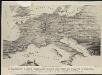
Orbis Romani Pars Occidentalis.
1 : 10137600 Lucas, Fielding Jr.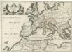
Patriarchatus Romanus
1 : 11100000 Mollova mapová sbírka Sanson, Nicolas Covens, Johannes I
Karte von mittel und sued Europa
Evropa Hauslab, Franz von Artaria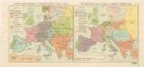
Rozsah panství Habsburků ... za Karla V. (1555) Říše Napoleonova (1810) a Evropa po kongresu Vídeňském (1815)

Orbis Romani pars occidentalis
1 : 10000000
Imperii Romani, distracta
1 : 22200000 Evropa střední Bonne, Rigobert André
Imperii Romani.
1 : 9850000 Vivien de St Martin, L.
Orbis Romani, pars occidentalis.
1 : 4300000 Anville, Jean Baptiste Bourguignon d, 1697-1782
Theatrum Historicum :
1 : 8500000 Mollova mapová sbírka Delisle, Guillaume Desrosiers, F. L'Isle, Guillaume de
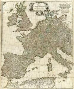
Europe
1 : 4000000 Evropa Andriveau-Goujon, E. E. Andriveau-Goujon
Carte des costes maritimes de l'Europe
1 Karte : Kupferdruck ; 64 x 48 cm Nolin; Basset; Basset chez Basset rue St. Jacques
Carte des costes maritimes de l'Europe
1 Karte : Kupferdruck ; 64 x 48 cm Nolin; Daumont chez Daumont rue de la Feronnerie
Carte Routiere et Postale de la France

[Personifizierte Europa als Königin mit Reichsapfel und Zepter, Hispania bildet den Kopf]
1 Karte : Holzschnitt ; 16 x 26 cm Münster, Sebastian [Sebastian Münster]
[Personifizierte Europa als Königin mit Reichsapfel und Zepter, Hispania bildet den Kopf]
1 Karte : Holzschnitt ; 16 x 26 cm Münster, Sebastian [Sebastian Münster]
Landtaflen
1 Atlas [von Johannes Stumpf] Christoffel Froschower, Zürych
Nová mapa vysílacích stanic Evropy
Evropa Hlaváček, Josef Orbis
Carte genérale et itineraire de l'Europe
1 : 2300000 Evropa Traux, Maximilian de Schwarzenberg, Karel Filip Artaria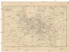
Cestovní spoje v Evropě
Evropa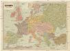
Evropa
1 : 5000000 Evropa V. Neubert
Orbis Romani, occidentalis.
1 : 11500000 Anville, Jean Baptiste Bourguignon d, 1697-1782; M'Dermut, Robert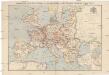
Compagnie Internationale des Wagons-lits et des Grands Express européens
1 : 4500000 Evropa L. Hermann
Orbis Romani pars occidentalis, auspiciis serenissimi principis Ludovici Philippi Aurelianorum ducis publici juris facta
1 : 4300000