Maps of Greece

Griechenland, Kleinasien XIten.-Mitte des XIIIten. Jhdts.
1 : 3800000 Spruner von Merz, Karl
Griechenland, Kleinasien, Eroberung Konstantinopel's, 1453.
1 : 3800000 Spruner von Merz, Karl
Carte de la Grece.
1 : 2500000 L'Isle, Guillaume de, 1675-1726
Carte de la Grece.
1 : 2500000 L'Isle, Guillaume de, 1675-1726
Graecia, Sophiani.[Karte], in: Theatrum orbis terrarum, S. 514.
1 Karte aus Atlas Ortelius, Abraham Vrients, Jan Baptista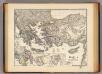
Graecia tempore migrationis doricae.
1 : 3800000 Menke, Th.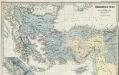
Osmânisches Reich und Nachbarländer 1391 bis 1452
1 : 5000000 Osmanisches Reich, Balkanhalbinsel Menke, Theodor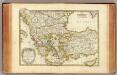
Turquie.
1 : 3900000 Janvier, Jean
Turquie d'Europe
1 : 2650000 par le Sr. Janvier, géographe A Vénice : par François Santini [...] chez M. Redini
Nieuwe kaart des Zuiderdeels van 't Europisch Turkyen
1 : 7000000 [S.l.] : [s.n.]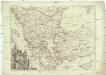
Turquie d'Europe
1 : 2500000 Turecko západní Janvier, Jean Denis Redine, M. Francois Santini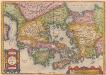
[Hellás], Graecia Sophiani. [Karte], in: Theatrum orbis terrarum, S. 404.
1 Karte aus Atlas Ortelius, Abraham

Das Byzantinische Reich bis in das XIte. Jahrhundert.
1 : 3800000 Spruner von Merz, Karl
Geographie des temps heroiques de la Grece; Homere, Hesiode les argonautes.
Vivien de Saint-Martin, M.
Universae Graeciae antiquae tabula geographica
1 : 1350000 Ilýrie Kruse, Friedrich Klein, Ernst sumtibus Ernesti Klein
Ellas : Graecia, Sophiani / Abrahamo Ortelio descriptore
1 : 2500000 titelvariant: Graecia, Sophiani; Hellas; Annotatie: De kaart is uitgegeven in de periode 1597-1624; Cum priuilegio; Origineel is Blad 170 in atlas factice; Annotatie geografische gegevens: 4 schaalstokken: 1000 Stadia, en: 60 Mil. Germ., en: 70 Mil. Gall., en: 240 Mil. Ital [S.l. : Abraham Ortelius]
Imperium Latinorum
Lateinisches Kaiserreich
Asie Mineure
Nouvel atlas physique politique et historique de l'Empire ottoman et des états limitrophes en Europe, en Asie et en Afrique, en quarante feuilles Hellert, J.J. Bellizard, Dufour et Cie
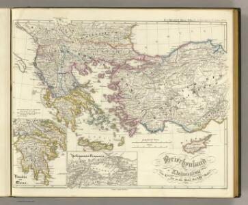
Griechenland nach den Balkankriegen
Griechenland Balkankriege Häusler, Ines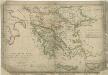
Atlas orbis antiqui totius secundum optimos scriptores ...

Asia Minor [Karte], in: Atlas nouveau, contenant toutes les parties du monde [...], Bd. 2, S. 222.
1 Karte aus Atlas Sanson, Nicolas Jaillot, Alexis Hubert und Mortier, Pieter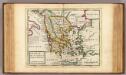
Greece or the south part of Turky in Europe.
1 : 4700000 Moll, Herman, d. 1732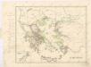
Staré Řecko

Turska i Grčka
1 : 5000000 Rumunsko G. Freytag i Berndt
Graecia cum terris adjacentibus
Griechenland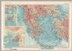
Albania, Greece. Pergamon World Atlas.
1 : 2500000 Polish Army Topography Service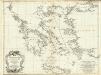
Les Cotes de la Grece et l'Archipel.
1 : 1340000 Anville, Jean Baptiste Bourguignon d, 1697-1782
Grece moderne, Archipel, Albanie, Macedoine.
1 : 2400000 Picquet, C.