Maps of Ukraine

Polen bis zu seinem Untergange 1795.
1 : 5000000 Spruner von Merz, Karl
Polen nach der dritten Theilung 1795
1 : 20000000 Polen Teilung Polens <1795>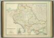
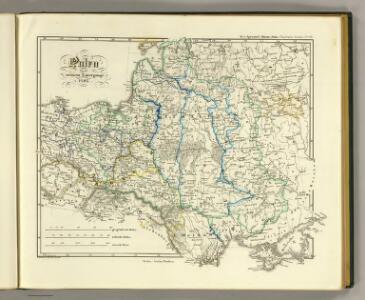
South-West Russia.
1 : 3456000 Johnston, W. & A.K.
Polen und Litthauen 1125-1386.
1 : 5000000 Spruner von Merz, Karl
Polen nach der ersten Theilung 1772
1 : 20000000 Polen Teilung Polens <1772>
Polen vor dem Frieden v. Andrussow 1667
1 : 20000000 Polen-Litauen Russisch-polnischer Krieg <1654-1667>
Polen nach der zweiten Theilung 1793
1 : 20000000 Polen Teilung Polens <1793>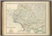
South-West Russia.
1 : 3456000 Johnston, Alexander Keith
Polska za Władysława Łokietka roku 1333
Evropa jihovýchodní
Lechia za Bolesława Wstydliwego roku 1279
Evropa jihovýchodní
Polska czyli Lechia od Bolesława Krzywoustego między synów podzielona roku 1139
Evropa jihovýchodní
Polen und Litthauen unter den Jagjellonen 1386-1572.
1 : 5000000 Spruner von Merz, Karl
Poland.
from Carey's general atlas, improved and enlarged : being a collection of maps of the world and quarters, their principal empires, kingdoms, &c.

Polen vom Anfange des XVIII Jahrhunderts bis zum Untergange der Republik 1795
1 : 5000000 Polen-Litauen, Teilungen Polens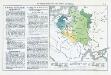
Die Teilung Polens und seine spätere Entwicklung
Polen Teilungen Polens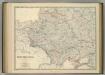
South-West Russia.
1 : 3456000 Johnston, Alexander Keith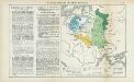
Nr. 15. Die Teilung Polens und seine spätere Entwicklung
Polen Teilungen Polens
Polska za Stefana Batorego roku 1586
Evropa jihovýchodní
Polska za Mieczysława I. roku 992
Evropa jihovýchodní
Polska za Kazimirza Wielkiego roku 1370
Evropa jihovýchodní
Sławiańszczyzna przed powstaniem Polski roku 850
Evropa jihovýchodní
Polska za Jana Alberta roku 1500
Evropa jihovýchodní
Polska za Jana Kazimirza i za Michała Wisniowieckiego 1673, klęski od roku 1648 do 1717
Evropa jihovýchodní
Polska za Zygmunta Augusta roku 1572
Evropa jihovýchodní
Polska za Stanisława Augusta podzielona 1772, 1793, 1795
Evropa jihovýchodní
Polska za Bolesława Wielkiego roku 1025
Evropa jihovýchodní
Polen und Litthauen nach der Lubliner Union 1569 und dem Aussterben der Jagiellonen 1572
1 : 12000000 Polen-Litauen
Karte von Polen und den ehemals dazu gehörigen Provinzen
1 : 8200000 Bělorusko Sotzmann, Daniel Friedrich von D.F. Sotzmann