Maps of Baltic Plains

Die Ostsee-Laender, Polen und Litthauen im Aufange des XIIIten. Jahrhunderts.
1 : 3800000 Spruner von Merz, Karl
Baltic States & East Prussia.
1 : 2000000 John Bartholomew and Son
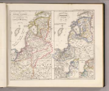
Das Gebiet des Deutschen Ordens in den Ostseeländern in seiner grössten Ausdehnung vor der Schl. v. Tannenberg 1410
Preußen (Ordensstaat)
Voenno-dorožnaja karta časti Rossii i pograničnych zemelʹ
1 : 1680000 Baltikum, Ostpreußen Šubert [Generalmajor]
Das Gebiet des Deutschen Ordens in den Ostseeländern in seiner grössten Ausdehnung vor der Schl. v. Tannenberg 1410
Preußen (Ordensstaat)
Russische Gouvernementseinteilung vor der deutschen Besatzung
Baltikum Kurland (Gouvernement) Ėstljandskaja Gubernija Riga (Gouvernement)
Poland, Prussia.
1 : 4400000 Darton, William
Map of the several countries thro' which the Russians are to pass in their march to Prussia
1 : 5259000
Poland.
1 : 3576320 Cummins Map Co.
Übersichtskarte des Östlichen Kriegsschauplatzes
1 : 4500000 Osteuropa Polen Litauen Weißrussland Galizien und Lodomerien Weltkrieg <1914-1918> Verl. Gerhard Stalling, Oldenburg
18. Soviet Republics in North-Central The World Atlas. Europe.
1 : 3000000 USSR (Union of Soviet Socialist Republics).
Royaume de Pologne et duché de Lithuanie
1 : 5180000 Litva Bonne, Rigobert André
Poland.
1 : 2400000 Playfair, Principal
Partie, Russie. Europe 9.
1 : 1641836 Vandermaelen, Philippe, 1795-1869
Nr. 15. Der Krieg in Westrußland im Herbst 1915
Polen Weltkrieg <1914-1918>, Ostfront
Livoniae Nova Descriptio [Karte], in: Theatrum orbis terrarum, S. 280.
1 Karte aus Atlas Ortelius, Abraham
Livoniae Nova Descriptio [Karte], in: Theatrum orbis terrarum, S. 375.
1 Karte aus Atlas Ortelius, Abraham Vrients, Jan Baptista
Carte géologique de la République Polonaise
1 : 2500000 Kuźniar, Czesław; (Pologne) Service Géologique Lwów : Service Géologique de Pologne
Carte réduite de la mer Baltique, 2
1 Blatt : 73 x 60 cm Froullé
Reliefkarte der Ostsee von Danzig bis Petersburg
Gdaňsk-oblast (Polsko) Franckh'sche Verlagshandlung
Prusse, Lithuanie.
1 : 3200000 Clouet, J. B. L. (Jean-Baptiste Louis), b. 1730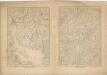
Kriegs Atlas 36 Karten von den Schauplätzen des Weltkrieges 1914/1915

Tableau des opérations de la Grande Armée depuis l'ouverture de la campagne jusqu'au 21 Aout 1812
1 : 2300000

Östlicher Kriegsschauplatz I
1 : 5000000 Ostmitteleuropa Weltkrieg <1914-1918>, Ostfront
Livonia [Karte], in: Atlas, sive, Cosmographicae meditationes de fabrica mundi et fabricati figura, S. 150.
1 Karte aus Atlas Mercator, Gerhard
Magni dvcatvs Lithvaniae, caeterarvmqve regionvm illi adiacentivm exacta descriptio / sculptum apud
1 : 1300000 1 Karte auf 4 Blatt : Kupferdruck ; 73 x 71 cm Blaeu, Willem Janszoon excudebat Guilhelmus Janssonius sub signo solarij deaurati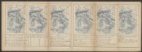
Livonia, Vulgo Lyeftland. [Karte], in: Le théâtre du monde, ou, Nouvel atlas contenant les chartes et descriptions de tous les païs de la terre, Bd. 1, S. 64.
1 Karte aus Atlas Blaeu, Willem Janszoon und Blaeu, Joan Blaeu, Willem Janszoon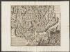
Livonia, Vulgo Lyefland. [Karte], in: Theatrum orbis terrarum, sive, Atlas novus, Bd. 1, S. 64.
1 Karte aus Atlas Blaeu, Joan Blaeu, Willem Janszoon