Maps of Germany

Deutschland unter den Hohenstaufen, und bis 1275.
1 : 3800000 Spruner von Merz, Karl
Germany.
1 : 2400000 Playfair, Principal
Deutschland von Rudolf von Habsburg bis Maximilian I, 1275-1495.
1 : 3800000 Spruner von Merz, Karl
Germania Antiqua.
1 : 4900000 Delamarche, Felix
Hydrographica Germaniae...
Deutschland zu Anfang des dreissigjährigen Krieges, 1618
Evropa střední Goedsche & Steinmetz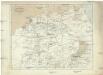
Deutschland unter den sächsischen und fränkischen Kaisern bis 1138
Evropa střední Goedsche & Steinmetz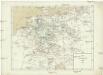
Deutschland im Jahre 1792
Evropa střední Goedsche & Steinmetz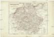
Deutschland unter den Hohenstaufen
1 : 6000000 Evropa střední Goedsche & Steinmetz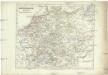
Deutschland zur Zeit der Reformation
1 : 6000000 Evropa střední Goedsche & Steinmetz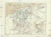
Deutschland im Jahre 1512
Evropa střední Goedsche & Steinmetz
Tabula Novissima Totius Germaniae
1 : 1300000 Mollova mapová sbírka Eisenschmidt, Johann Caspar Homann, Johann Baptista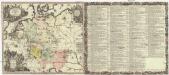
Historia Imperii Romano-Germanici, nec non finitimarum regionum
1 : 2700000 Evropa střední Seutter, Matthäus Matthaeo Seutter
Historia Imperii Romano-Germanici, nec non finitimarum regionum
1 : 2700000 Evropa střední Seutter, Matthäus Matthaeo Seutter
Mappa geographica exhibens postas omnes tam vehiculares quam veredarias totius Germaniae cum earum accurata distantia
1 : 2500000 diligentissime propriis sumptibus excudit Tobias Conrad Lotter Aug. Vindelicor : Tob. Conr. Lotter
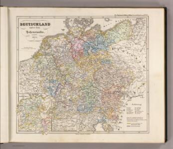
Deutschland von 1792 bis zur Gegenwart.
1 : 3800000 Spruner von Merz, Karl
Neueste Eisenbahn-Karte von Deutschland und den angrenzenden Ländern
Evropa střední Walseck, Georg Georg Walseck
Charte von Deutschland und den angränzenden Theilen der benachbarten Länder
1 : 1310000 Evropa střední Güssefeld, Franz L. Homanns Erben
Bez titulu: soubor map pag. 125

Postarum seu cursorum publicorum diverticula et mansiones per Germaniam et confin. provincias
Evropa střední Seutter, Matthäus opera et manu M. Seutteri
Postarum seu cursorum publicorum diverticula et mansiones per Germaniam et confin. provincias
Evropa střední Seutter, Matthäus opera et manu M. Seutteri
Postarum seu cursorum publicorum diverticula et mansiones per Germaniam et confin. provincias
Belgie Seutter, Matthäus opera et manu M. Seutteri
Tabula Germaniae
1 : 2780000 Evropa střední Visscher, Claes Jansz. Broeck, Abraham van den Claes Ianßen Visscher excudebat
Imperium Romano-Germanicum in suos circulos electorat. et status
1 : 2700000 Evropa střední Seutter, Matthäus apud Matth. Seutter
Imperium Romano-Germanicum in suos circulos electorat. et status
1 : 2700000 Evropa střední Seutter, Matthäus Matth. Seutter
Imperium Romano-Germanicum in suos circulos electorat. et status
1 : 2700000 Evropa střední Seutter, Matthäus Matth. Seutter
Post- & Reise- Karte von Deutschland und den nachbar Staaten
1 : 2200000 Evropa střední Kunsch, H. Handtke, F. C. Flemming
Imperium Romano-Germanicum
1 : 2600000 Mollova mapová sbírka Seutter, Matthäus Seutter, Matthäus
Post und Reise-Karte von Deutschland und den anliegenden Ländern für Extraposten, Couriere, Diligencen und Eilwagen
Evropa střední Bär, Johann Christoph Diez, F. M. J. Perthes
Post und Reise-Karte von Deutschland und den anliegenden Ländern für Extraposten, Couriere, Diligencen und Eilwagen
Evropa střední Bär, Johann Christoph Diez, F. M. J. Perthes