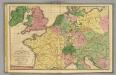
Maps of France
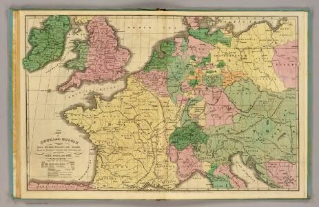
Central Europe.
1 : 4800000 Woodbridge, William C.
Geognost. Karte, Central- u. West-Europa.
1 : 4070000 Meyer, Joseph, 1796-1856
Gran carta del teatro della guerra nel 1870
1 : 2340000 Evropa střední Stabilimento civelli
Gallia Germania Britannia
Schul-Atlas der alten Welt bei Justus Perthes
Geognostische Übersichts-Karte von Deutschland, Frankreich, England und den angrenzenden Laendern
Francie Buch, Leopold von Dechen, Heinrich von bei Simon Schropp et Comp.
Gallia, Britannia, Rhaetia, Noricum, Pannonia, Germania
Galie
Kriegszusammenhänge IV (1740 - 1763)
1 : 15000000 Europa Österreichischer Erbfolgekrieg , Schlesische Kriege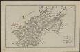
Schul-Atlas für die alte Erdbeschreibung : zur allgemeinen Schul-encyclopädie gehörig
J. H. Campe Zusammensetzung und Zeichnung von [...] Dufour, unter Leitung von Heusinger ; gestochen von Frentzel. Braunschweig : Schulbuchhandlung
West- u. Mittel- Europa im Zeitalter Napoleons (bis 1810)
Evropa střední F. Tempsky
Neueste Eisenbahn-Karte von Central-Europa
1 : 4000000 Evropa střední Issleib & Rietzschel
Gallia, Britannia, Germania, Provinciae danuvienses.
1 : 5000000 Kiepert, Heinrich, 1818-1899
Carte des routes de postes de l'Empire francais du royaume d'Italie et de la Confédération du Rhin
Evropa západní Tardieu, Pierre François
[Historisch-geographischer Atlas zu den allgemeinen Geschichtswerken von C. v. Rotteck, Pölitz u. Becker] : Gallien, Britannien, Germanien und die obern Donau-Länder nach Cæsar, Tacitus, Ptolemæus, Plinius, etc.
von Joh. Val. Kutscheit Lithographie der Herderschen Verlags-Handlung zu Freiburg im Breisg. [Freiburg im Breisgau] : [Herder]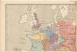
Evropa raného středověku: do konce VI. století po Kr.
Kašpar, Jan
Itineraire-Karte
1 : 6000000 Evropa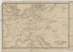
Übersichtskarte des Eisenbahn- und Telegraphen-Verbindungen von Mittel-Europa
1 : 6170000 Evropa střední Mayer, Alexander
Západní Evropa při konci XIV. věku

France, Switzerland, Germany.
Goodrich, S.G.
Kriegszusammenhänge I (1618 - 1660)
1 : 12000000 Ostmitteleuropa Dreißigjähriger Krieg, Nordischer Krieg <1655-1660>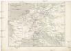
Napoleon's Kaiserreich im Jahre 1812
Evropa západní
Quarta Europae Tabula. [Magna Germania] [Karte], in: Claudii Ptolemei viri Alexandrini mathematice discipline philosophi doctissimi geographie opus [...], S. 160.
1 Karte aus Atlas Waldseemüller, Martin [und Ptolemaeus, Claudius] Übelin, Georg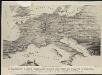
Stannard & Son's, panoramic birds-eye view of France & Prussia and the surrounding countries likely to be involved in the War, with the railways & startegic positions of each army, & the great fortresses of the Rhine provinces
1 : 1
Eisenbahn und Telegraphen-Karte von Europa
Evropa Kastner, Leopold Hacker, Ant. Mechitharisten-Buchdruckerei
Eisenbahn und Telegraphen-Karte von Europa
Evropa Kastner, Leopold Hacker, A.

[Historisch-geographischer Atlas zu den allgemeinen Geschichtswerken von C. v. Rotteck, Pölitz u. Becker] : Das Reich Karls des Grossen nach der Theilung seiner Enkel zu Verdun 843
von Julius Loewenberg Lithographie von B. Herder in Freiburg im Breisgau [Freiburg im Breisgau] : [Herder]
Rozšíření nejstarší keramiky české v Evropě
Evropa
Die Verbreitung des Kropfes in Mittel-Europa
1 : 8000000 Bircher, Heinrich Benno Schwabe, Schweighauserische Verlagsbuchhandlung