Maps of United States Minor Outlying Islands
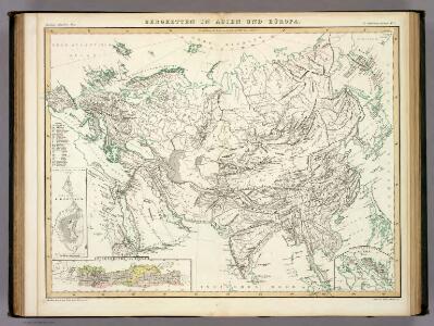
Bergketten In Asien Und Europa.
1 : 21000000 Berghaus, Heinrich
Die Volker Asien's Und Europa's.
1 : 30000000 Berghaus, Heinrich
Bergketten in Asien und Eüropa / Potsdam, gez. u. gest. in der geogr. Kunstschule
1 : 28000000 1 Karte : Kupferdruck ; 32 x 43 cm Berghaus, Heinrich Karl Wilhelm J. Perthes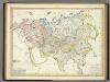
Asia-Europa; in Beziehung auf das Fliessende, und seine Vertheilung in Stromgebiete.
1 : 30000000 Berghaus, Heinrich
North America. Pergamon World Atlas.
1 : 45000000 Polish Army Topography Service
lustrated Times map of North America
1 : 13500000 Ettling, Theodor Illustrated Times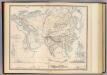
Physical Europe & Asia.
1 : 20000000 Johnston, Alexander Keith, 1804-1871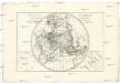
Mappe-monde sur un plan horisontal
Afrika
Stromgebiet, Nordamerica.
1 : 31000000 Radefeld, Carl Christian Franz, 1788-1874
Amerique du Nord spheroidale.
1 : 41000000 Garnier, F. A., 1803-1863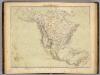
Nord-Amerika.
1 : 18500000 Ziegler, J. M.
Nord America.
1 : 26500000 Flemming, Carl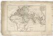
Orbis antiquus
1 : 85600000 Afrika Bonne, Rigobert André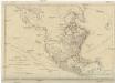
NORTH AMERICA, AS DIVIDED amongst THE EUROPEAN POWERS
Severní Amerika Dunn, Samuel
Nord America
Malé Antily (souostroví)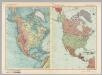
North America - Physical - Political. Pergamon World Atlas.
1 : 30000000 Polish Army Topography Service
North America.
1 : 29000000 Colton, G.W.
178. North America, Communications. The World Atlas.
1 : 25000000 USSR (Union of Soviet Socialist Republics).
[Bergketten in Asien und Europa]
Erster Band, enthaltend in vier Abtheilungen die Erscheinungen der anorganischen Natur: 1. Meteorologie und Klimatographie. 2. Hydrologie und Hydrographie. 3. Geologie. 4. Tellurischer Magnetismus Humboldt, Alexander von Verlag von Justus Perthes
North America.
1 : 3100000 Hughes, William
Amerique de Nord Politique.
1 : 20000000 Vivien St Martin, L.
[Asia-Europa; in Beziehung auf das Fliessende, und seine Vertheilung in Stromgebiete]
Erster Band, enthaltend in vier Abtheilungen die Erscheinungen der anorganischen Natur: 1. Meteorologie und Klimatographie. 2. Hydrologie und Hydrographie. 3. Geologie. 4. Tellurischer Magnetismus Humboldt, Alexander von Verlag von Justus Perthes

Nord America.
1 : 15000000 Kiepert, Heinrich, 1818-1899
North America.
1 : 34000000 Tanner, Henry S.
North America.
1 : 56000000 Adams, Daniel
Asia and adjacent regions
1 : 15000000 Asie National Geographic Society
Amerique de Nord Physique.
1 : 20000000 Vivien St Martin, L.
North America.
1 : 7500000 Tanner, Henry S.
North America.
1 : 7500000 Tanner, Henry S.
Composite: North America.
1 : 7500000 Tanner, Henry S.