Maps of Seven Seas (Open Ocean)
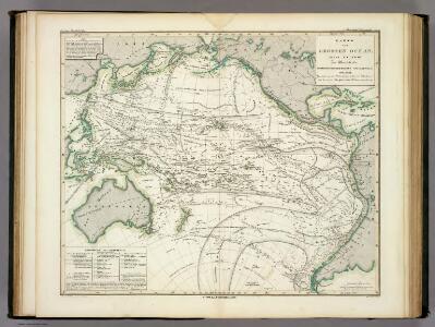
Karte vom Grossen Ocean, (Mare Pacifico).
1 : 90000000 Berghaus, Heinrich
Pacific Ocean.
1 : 45000000 Johnston, Alexander Keith, 1804-1871
Der Vulkan-Gürtel und die Central-Gruppen des Grossen Oceans
Tichý oceán Buch, Leopold von
Productenkaart der Aarde / neu bearb. Osw. Meinke
1 : 54600000 Meinke, Osw. Esslingen : Harburger
Karte von dem Vulkan Gurtel.
1 : 65000000 Berghaus, Heinrich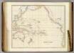
Pacific Ocean.
1 : 40000000 Arrowsmith, John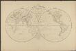
Mappemonde en deux hémisphères où sont tracées les lignes de faîte des grands bassins qui partagent la surface du globe
1 : 44000000 par L. Vivien gravé par Desbuisson [...] ; écrit par Arnoul Paris : Hachette
Afrique spheroidale.
1 : 41000000 Garnier, F. A., 1803-1863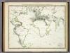
Die Vulkanischen Erscheinungen Der Atlen Welt.
1 : 65000000 Berghaus, Heinrich
Pacific Ocean.
1 : 57000000 Goodrich, S.G.
Picture of the World.
1 : 89000000 Huntington, Hezekiah, 1795-1865
Oceania, or Islands in the Pacific Ocean.
1 : 41000000 Fullarton, A. & Co.
Maris Pacifici (quod vulgo Mar del Zur) cum regionibus circumiacentibus, insulisque in eodem passim sparsis, novissima descriptio
1 : 42000000 Ortelius, Abraham Libraria Plantiniana
Pacific.
1 : 75000000 Andree, Richard; Times (London, England)
Pacific Ocean.
1 : 86000000 Smiley, Thomas T.
Grosser Ocean.
1 : 75000000 Andree, Richard
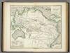
Map of Africa, showing its most recent discoveries ; Island of St. Helena [inset].
From Mitchell's new general atlas, containing maps of the various countries of the world, plans of cities, etc., embraced in fifty-three quarto maps., forming a series of eighty four maps and plans, together with valuable statistical tables.
Pacific Ocean.
1 : 35000000 Arrowsmith, John
Orbis Terrarum Veteribus Cogniti Typus Geographicus. [Karte], in: Novus atlas absolutissimus, Bd. 10, S. 8.
1 Karte aus Atlas Janssonius Offizin
Pacific Ocean cables, wireless stations.
1 : 50000000 Philip, George
Objevy zemí na hranici středního a nového věku

Longueurs du pendule.
1 : 75000000 L'Isle, Guillaume de, 1675-1726
Pacific Ocean.
1 : 90000000 Arrowsmith, Aaron; Lewis, Samuel
Mappe-Monde = Geo-Hydrographique, ou Descritption Generale Du Globe Terrestre Et Aquatique En Deux-Plans-Hemispheres. [Karte], in: Atlas nouveau, contenant toutes les parties du monde [...], Bd. 1, S. 32.
1 Karte aus Atlas Sanson, Nicolas Jaillot, Alexis Hubert und Mortier, Pieter
Die sichtbare Seite der Mond-Oberflache bei voller Beleuchtung.
1 : 13000000 Stieler, Adolf
Oceana Or Pacific Ocean.
1 : 55000000 Tanner, Henry S.
Oceana Or Pacific Ocean.
1 : 55000000 Tanner, Henry S.
Oceana Or Pacific Ocean.
1 : 57500000 Mitchell, Samuel Augustus