Maps of Massachusetts

A Map of the New England States.
1 : 520000 Hale, Nathan
New England States.
1 : 520000 Hale, Nathan
New England, Eastern New York.
1 : 805000 Rand McNally and Company
New England States.
1 : 520000 Hale, Nathan
Eastern States.
1 : 2400000 D.F. Robinson & Co.
Railway map New England States.
1 : 1175000 George K. Snow & Bradlee
Railway map New England States.
1 : 1175000 George K. Snow & Bradlee
Telegraph and rail road map of the New England states

Williams' telegraph and rail road map of the New England states, eastern portion of New York state and Canada

Map of New England exhibiting the rail and telegraphic lines now in operation
Brown & Hastings Coolidge & Wiley
Massachusetts and Rhode Island.
from The cerographic atlas of the United States. By Sidney E. Morse, A.M., and Samuel Breese, A.M.
Boston Clinton Fitchburg and Mansfield Framingham Lowell Railroads, and connections
1 : 2700000 American Bank Note Company
Vermont, Massachusetts, Rhode Island, and Connecticut.
1 : 4384000 Fisher, Richard Swainson
Map New England

New Hampshire, Vermont, Massachusetts, Rhode Island, and Connecticut.
1 : 1270000 Asher & Adams
The New England states and part of Canada
[Map of New England, 31st]
N.H., Vt., Mass., R.I., Conn.
1 : 1267200 Asher & Adams
The New England commercial and route survey

Post route map of the states of New Hampshire, Vermont, Massachusetts, Rhode Island, Connecticut, and parts of New York and Maine
1 : 380160 Nicholson, W. L. United States. Post Office Dept.
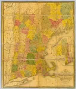
Map of the northern, or, New England states of America, comprehending Vermont, New Hampshire, District of Main, Massachusetts, Rhode Island, and Connecticut

Post route map of the states of New Hampshire, Vermont, Massachusetts, Rhode Island, Connecticut, and parts of New York and Maine
1 : 380160 Nicholson, Walter L. United States. Post Office Dept.
New England, Middle States.
Adams, Daniel
Map of the Sherbrooke, Eastern Townships and Kennebec Railway : with connections
1 : 1267200 G.W. & C.B. Colton & Co G.W. & C.B. Colton & Co.
Vermont, New Hampshire, Massachusetts, Rhode Island, and Connecticut.
1 : 1077000 Johnson, A.J.
The colonies in 1660, New England and New Netherland showing extent and dates of settlement
1 : 3000000 Myers, Albert Cook Burrows Brothers Company
National map of the American Republic.
from Whole
The north eastern coast, North America, New York to Cape Canso (west sheet)
1 : 910000 Wadsworth, A. S. (Alex. S.)
199. New England. The World Atlas.
1 : 125000 USSR (Union of Soviet Socialist Republics).
New England.
1 : 1330560 Cram Atlas Company
Map of Maine, New Hampshire, Vermont, Massachusetts, Rhode Island, and Connecticut.
1 : 633600 Burr, David H., 1803-1875