Maps of Mount Vernon
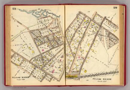
128-129 Pelham Manor.
1 : 5400 G.W. Bromley & Co.
130-131 Pelham.
1 : 5400 G.W. Bromley & Co.
Pelham town, village.
1 : 3600 Bromley, George Washington; Bromley, Walter Scott; G.W. Bromley & Co.
Planning Grid of the Office of the Topographical Bureau of Bronx.
from Topographical survey and new street system of the borough of the Bronx, easterly of the Bronx River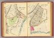
106-107 Mt. Vernon.
1 : 3600 G.W. Bromley & Co.
2D - N.Y. City (Aerial Set).
from Sectional aerial maps of the City of New York / [photographed and assembled under the direction of the chief engineer, July 1st, 1924].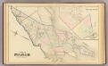
Pelham, Pelham-Manor.
1 : 14400 Bromley, George Washington; Bromley, Walter Scott; G.W. Bromley & Co.
Height District Map Section No. 2; Height district map / City of New York, Board of Estimate and Apportionment.
from Height district map / City of New York, Board of Estimate and Apportionment. New York (N.Y.). Board of Estimate and Apportionment,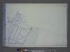
Use District Map Section No. 2; Use district map / City of New York, Board of Estimate and Apportionment.
from Use district map / City of New York, Board of Estimate and Apportionment. New York (N.Y.). Board of Estimate and Apportionment,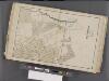
Westchester, Double Page Plate No. 9 [Map bounded by Pelham, Randal Ave., Mundys Lane, E. 5th St.] / prepared under the direction of Joseph R. Bien, from general surveys and official records.
From Atlas of Westchester County, New York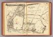
132-133 Pelham, New Rochelle.
1 : 5400 G.W. Bromley & Co.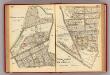
126-127 Pelham Manor, New Rochelle.
1 : 5400 G.W. Bromley & Co.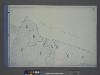
Area District Map Section No. 2
from Area district map / City of New York, Board of Estimate and Apportionment.
Sheet 29: Map of Pelham Bay Park, City of New York, forming sheet 29 of the Topographical Atlas of the Territory East of the Bronx River.
from Topographical survey and new street system of the borough of the Bronx, easterly of the Bronx River
E. Chester, Town.
1 : 21120 Beers, F. W. (Frederick W.)
Westchester, Pelham towns.
1 : 21120 Bien, Joseph Rudolf
Yonkers and East Chester, Westchester County, New York.
1 : 23760 Beers, J.B.
Yonkers, Town.
1 : 19800 Beers, F. W. (Frederick W.)
Yonkers, Mt. Vernon, Eastchester towns.
1 : 21120 Bien, Joseph Rudolf
Mount Vernon
1 : 24000
Mount Vernon
1 : 24000
Mount Vernon
1 : 24000
Mount Vernon
1 : 24000
Mount Vernon
1 : 24000
Mount Vernon
1 : 24000
Mount Vernon
1 : 24000
Mt Vernon
1 : 24000
From New York to Stratford. (2)
1 : 35000 Colles, Christopher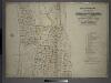
Index to Volume Two: Atlas of the Borough of the Bronx, City of New York. Part of 24th Ward.
from Atlas of the borough of the Bronx, city of New York : based upon official plans and maps on file in the various city offices; supplemented by careful field measurements and personal observations, by and under the supervision of Hugo Ullitz.