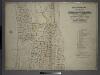
Maps of Mount Vernon
116-117 Mt. Vernon.
1 : 3600 G.W. Bromley & Co.
Mt. Vernon wards 1, 3, 5.
1 : 2400 Bromley, George Washington; Bromley, Walter Scott; G.W. Bromley & Co.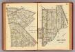
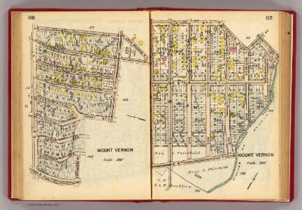
112-113 Mt. Vernon.
1 : 3600 G.W. Bromley & Co.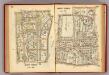
114-115 Mt. Vernon.
1 : 3600 G.W. Bromley & Co.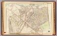
Pelham town, village.
1 : 3600 Bromley, George Washington; Bromley, Walter Scott; G.W. Bromley & Co.
Plate 55 & 56: Part of New Rochelle, Westchester Co. N.Y.
from County atlas of Westchester, New York. Published by J.B. Beers & Co., assisted by S.W. Wilson and others.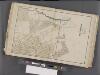
Westchester, Double Page Plate No. 9 [Map bounded by Pelham, Randal Ave., Mundys Lane, E. 5th St.] / prepared under the direction of Joseph R. Bien, from general surveys and official records.
From Atlas of Westchester County, New York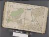
Westchester, Double Page Plate No. 12 [Map bounded by Pelham, E. 5th St., Rich Ave., East Chester] / prepared under the direction of Joseph R. Bien, from general surveys and official records.
From Atlas of Westchester County, New York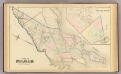
Pelham, Pelham-Manor.
1 : 14400 Bromley, George Washington; Bromley, Walter Scott; G.W. Bromley & Co.
Height District Map Section No. 2; Height district map / City of New York, Board of Estimate and Apportionment.
from Height district map / City of New York, Board of Estimate and Apportionment. New York (N.Y.). Board of Estimate and Apportionment,
Use District Map Section No. 2; Use district map / City of New York, Board of Estimate and Apportionment.
from Use district map / City of New York, Board of Estimate and Apportionment. New York (N.Y.). Board of Estimate and Apportionment,
Area District Map Section No. 2
from Area district map / City of New York, Board of Estimate and Apportionment.
E. Chester, Town.
1 : 21120 Beers, F. W. (Frederick W.)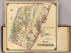
2 Yonkers.
1 : 18000 Hyde & Company
Plate 42: Town of Mamaroneck, Westchester Co. N.Y. - Orienta.
from Atlas of New York and vicinity : from actual surveys / by and under the direction of F. W. Beers, assisted by A. B. Prindle & others
Westchester, Pelham towns.
1 : 21120 Bien, Joseph Rudolf
Yonkers and East Chester, Westchester County, New York.
1 : 23760 Beers, J.B.
Yonkers, Town.
1 : 19800 Beers, F. W. (Frederick W.)
Yonkers, Mt. Vernon, Eastchester towns.
1 : 21120 Bien, Joseph Rudolf
Mount Vernon
1 : 24000
Mount Vernon
1 : 24000
Mount Vernon
1 : 24000
Mount Vernon
1 : 24000
Mount Vernon
1 : 24000
Mount Vernon
1 : 24000
Mount Vernon
1 : 24000
Mt Vernon
1 : 24000
From New York to Stratford. (2)
1 : 35000 Colles, Christopher
Plates 21 & 22: Town and City of Yonkers, Westchester Co. N.Y. - Town of East Chester, Westchester Co. N.Y.
From County atlas of Westchester, New York. Published by J.B. Beers & Co., assisted by S.W. Wilson and others.