Maps of Norway

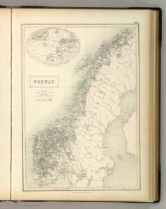
Norway.
1 : 4170000 Hughes, William
Shweden und Norwegen
Švédsko Seutter, Matthäus Zatta, Antonio
Spesielle kart nr 74: Strandfladen langs Norges kyst
1 : 2400000 Dr. Hans Reusch
Schweden und Norwegen
1 : 3342000 Norsko Weiland, Karl Ferdinand Geograph. Institut
Statistikk kart 15b: Norvège. Division militaire
1 : 2400000
Schweden und Norwegen
1 : 3340000 Norsko Weiland, Karl Ferdinand Bürck Geograph. Institut
Statistikk 9-2: Norvege. Mouvement de la population
1 : 2400000
Statistikk 26-5b: Udsæd af korn i tønder, reduceret til bygværdi pr. 1000 maal
1 : 2400000
Spesielle kart 66-1: Kart udvisende de med bidrag af Statskassen understøttende Dampskibsrouter
1 : 2400000
Statistikk 28- Le royaume de Norvège
1 : 2400000
Statistikk kart 11- Norvége
1 : 2400000
Statistikk 26-4c: Gjeder. Antal Dyr pr 1000 maal høstet Areal
1 : 2400000
Norge 78: Regni Norvegici Delineationovissima Finitimarumque Sveciæ Provinciarum
1 : 200000 S. O. de Falckenskiold
Statistikk kart 12-b: Norvège. Division administrative
1 : 2400000
Statistikk 26-5c: Heste. Middeltal pr Gaard
1 : 2400000
Statistikk 28-2: Le royaume de Norvège
1 : 2400000
Statistikk kart 17: Kart udvisende Forholdet mellem Fjeld og dyrket Mark
1 : 2400000
Statistikk 26-4b: Avling reduceret til Bygværdi.
1 : 2400000
Spesielle kart 66-2: Kart udvisende de med bidrag af Statskassen understøttende Dampskibsrouter
1 : 2400000
Schweden und Norwegen
Norsko Güssefeld, Franz L. Berra, Marco Marco Berra
Spesielle kart 66-3: Kart udvisende de med bidrag af Statskassen understøttende Dampskibsrouter
1 : 2400000
Statistikk kart 3: Folkemængdekart over Norge
1 : 1600000
Spesielle kart 5-3: Telegraf Kart over Norge
1 : 2000000
[Ost-Europa, Blatt 1]
Adolf Stieler's Handatlas über alle Theile der Erde und über das Weltgebäude Stieler, Adolf Justus Perthes
[Ost-Europa in 6 Blättern, Enthaltend: Norwegen, Schweden, Russland, Kaukasien und die Türkei, Blatt 1]
Hand-Atlas über alle Theile der Erde und über das Weltgebäude Stieler, Adolf Justus Perthes
Statistikk kart 14: Norvège. Division médicale
1 : 2400000
Spesielle kart 72a: Kart over Valgmands- og Stortingsvalgene
1 : 2400000 K. Petersen Olaf Norli's forlag; Kristiania
Statistikk kart 19-4: Fremstilling af Norges Agerbrug. Engdyrkning. Eng beregnet i procent af dyrket areal
1 : 2400000
[Ost-Europa in 6 Blättern, Blatt 1]
Handatlas über alle Theile der Erde und über das Weltgebäude Stieler, Adolf Justus Perthes