Maps of Massachusetts

New England States.
1 : 520000 Hale, Nathan
Railway map New England States.
1 : 1175000 George K. Snow & Bradlee
Railway map New England States.
1 : 1175000 George K. Snow & Bradlee
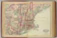
New England States.
1 : 520000 Hale, Nathan
New England, Eastern New York.
1 : 805000 Rand McNally and Company
A Map of the New England States.
1 : 520000 Hale, Nathan
Eastern States.
1 : 2400000 D.F. Robinson & Co.
Map of New England exhibiting the rail and telegraphic lines now in operation
Brown & Hastings Coolidge & Wiley
Telegraph and rail road map of the New England states

Williams' telegraph and rail road map of the New England states, eastern portion of New York state and Canada
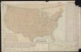
Parcel post map of the United States
1 : 7800000 L.L. Poates Engr'g Co. L.L. Poates Engr'g Co.
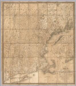
Map of New England with adjacent portions of New York & Canada
1 : 1537500 Walling, Henry Francis Walling, Henry Francis
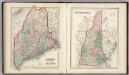
Vermont, Massachusetts, Rhode Island, and Connecticut.
1 : 4384000 Fisher, Richard Swainson
Map of New England with adjacent portions of New York & Canada
1 : 1537500 Walling, Henry Francis Walling, Henry Francis
New England.
1 : 1550000 Walling, H. F.
New England.
1 : 2550000 Huntington, Nathaniel G. (Nathaniel Gilbert), 1785-1848
Railroad map of New England & eastern New York : compiled from the most authentic sources
1 : 700000 Goldthwait, J. H Redding & Co. ; Clark, Austin & Co.
Map New England

G. Woolworth Colton's railroad, township & distance map of New England with adjacent portions of New York, Canada & New Brunswick
1 : 900000 Colton, G. Woolworth Colton, G. Woolworth
Boston Clinton Fitchburg and Mansfield Framingham Lowell Railroads, and connections
1 : 2700000 American Bank Note Company
The New England states and part of Canada

New England.
1 : 2100000 Mitchell, Samuel Augustus
New Hampshire, Vermont, Massachusetts, Rhode Island, and Connecticut.
1 : 1270000 Asher & Adams
Map of the northern, or, New England states of America, comprehending Vermont, New Hampshire, District of Main, Massachusetts, Rhode Island, and Connecticut

New England.
from A new systeme of the mathematicks: containing I. Arithmetick, as well natural and decimal, as in species, or the principles of algebra. II. Practical geometry, together with the first six books of Euclid's Elements, as also the eleventh and twelfth, symbo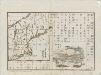
[Map of New England, 31st]
N.H., Vt., Mass., R.I., Conn.
1 : 1267200 Asher & Adams
Map of New England, with adjacent portions of New York & Canada

Massachusetts and Rhode Island.
from The cerographic atlas of the United States. By Sidney E. Morse, A.M., and Samuel Breese, A.M.