Maps of Piedmont
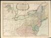
Delaware, Illinois, Indiana, Iowa ... North Carolina ... Tennessee, Virginia.
1 : 3000000 Lloyd, H.H.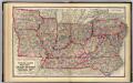
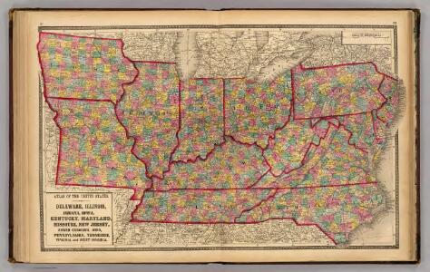
Delaware, Illinois, Indiana, Iowa ... North Carolina ... Tennessee, Virginia.
1 : 3000000 Walling, H. F.
151. Centers farm, agricultural products, population, manufactures.
1 : 7000000 Gannett, Henry, 1846-1914; United States. Census Office
126. Centers of population, farms, agricultural products, manufactures 1790-1900.
1 : 7000000 Gannett, Henry, 1846-1914; United States. Census Office
The Western Parts of Virginia, Pennsylvania, Maryland and North Carolina.
1 : 1140480 Hutchins, Thomas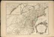
Partie de l'Amérique septentrionale, qui comprend le cours de l'Ohio, la Nlle. Angleterre, la Nlle York, le New Jersey, la Pensylvanie, le Maryland, la Virginie, la Caroline
1 : 3000000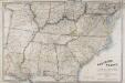
Map of the Southern States of North America, with the Forts, Harbours and Military Positions.
Map of the Southern States of North America, with the Forts, Harbours and Military Positions. Published by Wyld in 1862, Map of the Southern States of North America shows all the Confederate states, including the edge of Texas, and several of the Northern Border States too. Each state border is clearly defined. The map also labels ‘forts, harbours & military positions’, as well as marking the line between slave and free states, railways and canals. J. Wyld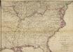
Woolley's new Map of the Seat of War in the Confederate States of America.
Woolley's new Map of the Seat of War in the Confederate States of America. Published in London, probably in 1861, Woolley’s New Map of the Seat of War in the Confederate States of America details the whole eastern half of the country. The red and green lines indicated which states held slaves and which states did not. The map shows all the Confederate states, excluding Texas, and shows how the Border States of Missouri and Kentucky were also slave-holding despite remaining part of the Union. H.G. Clarke & Co.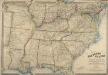
Map of the Southern States of North America, with the Forts, Harbours, and Military Positions
Map of the Southern States of North America, with the Forts, Harbours, and Military Positions. This map, published by Wyld in 1865, shows much of the Confederacy and the Border States as they were at the end of the Civil War. The divide between Virginia and West Virginia is marked, along with ‘forts, harbours & military positions’. The dark black lines indicated railway routes and it is notable how many more there are in the small segment of the Northern states displayed at the top of the map in comparison to the Confederate states. J. Wyld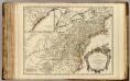
Cours de l'Ohio, Nlle. Angleterre, Nlle. York, Pensylvanie, Virginie, Caroline.
1 : 2900000 Robert de Vaugondy, Gilles, 1688-1766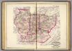
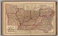
Ind., Ill., Mo., Ohio, Ky, Tenn.
1 : 2100000 Asher, Adams & Higgins; Higgins & Ryan
County map of the State of Illinois ; Plan of Chicago [inset].
from New general atlas.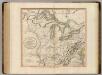
Western Terr., Kentucky, Pennsylvania, etc.
1 : 3300000 Cary, John, ca. 1754-1835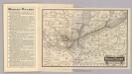
Map Wabash Railway.
1 : 6623200 Wabash Railway Company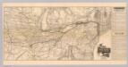
Map N.Y. Central & Hudson R. RR.
1 : 3104600 New York Central and Hudson River Railroad Company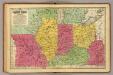
Western States.
1 : 3200000 Mitchell, Samuel Augustus
A Map of the British American plantations, extending from Boston in New England to Georgia, including all the back settlements in the respective provinces, as far as the Mississipi
1 : 6350000
Map of the Back Settlements.
1 : 6336000 Morse, Jedidiah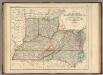
States Of Delaware, Maryland, Virginia (with the District of Columbia) North Carolina, Ohio, Kentucky, Tennessee, And Indiana.
1 : 3453120 Rogers, Henry Darwin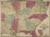
Lloyd's New Military Map of the Border and Southern States
Lloyd's New Military Map of the Border and Southern States. This map was published by H.H. Lloyd & Co. in 1862. The map shows mid America from the lower border of the Union to the eastern edge of Texas, thus showing all eleven Confederate states. Railway lines and fortifications are also labelled on the map.
Soil Map of the United States, Section 7. Atlas of American Agriculture.
1 : 2500000 Marbut, Curtis F.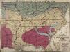
Lloyd's New Military Map of the Border and Southern States
Lloyd's New Military Map of the Border and Southern States. Lloyd’s New Military Map of the Border and Southern States from 1865 provides a clear example of the territory held by the Confederate and Union Armies at the end of the Civil War. The red parts indicated Confederate territory, now very much reduced compared to the other maps, the yellow parts show areas gained by the Union Army since early January 1862 and the blue part shows the route taken by General Sherman’s troops during their march through the South. The green indicates the Union. This map highlights how divided the Border States were with portions of Missouri and Kentucky coloured to indicate Union occupation. Although these both remained in the Union, internal civil struggles threatened to divide the states and Lincoln campaigned hard to ensure these states remained together. By comparison, Virginia witnesses an internal secession in 1863 and West Virginia can clearly be seen here on this map as part of the Union. This map is one of the best maps in the collection that detail how far the Union Army went into occupying the Confederate states and reuniting the country.
The state of Virginia : from the best authorities / by Samuel Lewis, 1809 ; Smither, sculpt.
from Carey's American atlas.
200-201. United States of America, North East Central. The World Atlas.
1 : 2500000 USSR (Union of Soviet Socialist Republics).
Country drained by the Mississippi Eastern Section.
1 : 4752000 Long, Stephen H.
Western U.S.
1 : 3000000 Cornell, S. S. (Sarah S.)
Western states, territories.
1 : 6400000 Grigg, John
N.W. Territory.
1 : 8553600 Scott, Joseph
Die Staaten von Missouri, Illinois, Indiana, Ohio, Kentucky und Tennessee