Maps of Canada

America, about 1670.
1 : 65000000 Wit, Frederik de
Nord-America
Hand-Atlas über alle Theile der Erde und über das Weltgebäude Stieler, Adolf Justus Perthes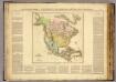
Amer. Septentrionale.
1 : 23500000 Buchon, J. A. C.; Carey, H. C.; Lea, I.
Nord America
1 : 16000000 entworfen und gezeichnet von C. F. Weiland gest. v. C. Jungmann Weimar : im Verlage des Geograph. Instituts
L'Amerique selon l'etendue de ses principales parties, 1
1 Blatt : mehrfarbig ; 49 x 61 cm Martin Will
Nord Amerika
Severní Amerika Schlieben Gleditsch
Nord America
1 : 27000000 Severní Amerika Handtke, F. C. Flemming
Nord-Amerika
Atlas der Pflanzengeographie über alle Theile der Erde Rudolphi, Ludwig Verlag der Nicolaischen Buchhandlung
Soubor němých map pro střední školy

Sewerní Amerika
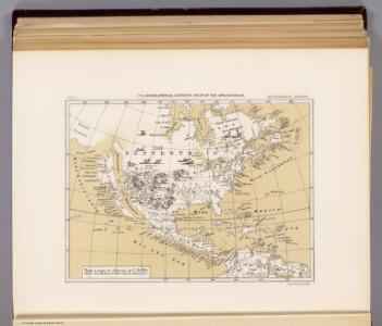
1 : 47230000 Severní Amerika
North America.
1 : 17500000 Black, Adam & Charles
Elementaratlas der allgemeinen Geographie in sechs Blättern No 4.
America river systems.
1 : 18500000 Johnston, Alexander Keith, 1804-1871
N. & S. America physical.
1 : 19500000 Rogers, Henry Darwin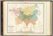
Asia, Europe river systems.
1 : 23000000 Johnston, Alexander Keith, 1804-1871
North America.
1 : 22500000 Tanner, Henry S.
[Severní Amerika]
Severní Amerika
Charte eines sehr grossen Landes zwischen Neü Mexico und dem Eysmeerische Groß Brittanische May[e]st[ät] Wilhelm III
1 : 20000000 Beringův průliv Hennepin, Louis Sauermann, P. J. bey P.J. Sauerman[n]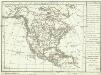
[Severní Amerika]
1 : 49400000 Severní Amerika
North America.
1 : 33000000 Morse, Jedidiah; Morse, Sidney E. (Sidney Edwards), 1794-1871
Soubor němých map pro gymnasia a odborné školy

Sewerní Amerika.

Flusskarte von Asien
1 : 35000000 Asie Radefeld aus der Geograph. Graviranstalt des Bibliograph. Instituts
Asie Politique.
1 : 25000000 Vivien St Martin, L.
Map of North America.
1 : 15000000 Smith, J. Calvin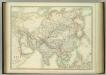
Asia.
1 : 20967600 Johnston, W. & A.K.
Asia-Eüropa in Beziehung auf das Fliessende, und seine Vertheilung in Stromgebiete / Potsdam, gez.
1 : 30000000 1 Karte : Kupferdruck ; 32 x 44 cm Berghaus, Heinrich Karl Wilhelm J. Perthes
North America.
1 : 23500000 Mitchell, Samuel Augustus
North America.
1 : 23500000 Mitchell, Samuel Augustus