Maps of Barwon South West
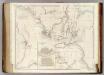
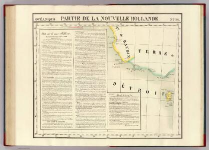
Partie, Nouvelle Hollande. Oceanique no. 56.
1 : 1641836 Vandermaelen, Philippe, 1795-1869
Fryers, Talbot County, Victoria (1865)
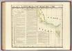
Victorian Water Supply. Plan shewing Auriferous Gullies in the Castlemaine and Fryerstown Mining Divisions commanded by the Coliban Scheme. Scale, 40 ch[ain]s to one inch.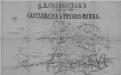
Castelemaine and Fryers Mines (1865)
R.H. Shakespear's Map of the Castlemaine and Fryer's Mines. Scale, 24 chains (1584 feet) to 1 inch.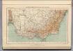
168. Australia di Sud-est.
1 : 3000000 Touring club italiano
Victoria Or Port Phillip.
1 : 2977920 Tallis, J. & F.
Map of the southern portion of South Australia
1 : 1000000 Jižní Austrálie Surveyor General's Office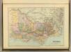
Victoria.
1 : 1900800 Stanford, Edward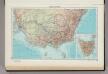
241. Australia, South East. Tasmania. The World Atlas.
1 : 3750000 USSR (Union of Soviet Socialist Republics).
Victoria, New South Wales, and South Australia.
1 : 5600000 Hughes, William
Composite: Australia 1:2,500,000.
1 : 2500000 John Bartholomew & Co.
Eastern Portion of Australia.
1 : 5068800 Arrowsmith, John
Australia - eastern section.
1 : 6000000 John Bartholomew & Co.
The British colonies of Australia
1 : 6500000 J. Addison delt. [&] sculpt. London : C. Smith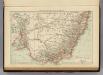
Victoria, New South Wales.
1 : 5000000 Andree, Richard; Times (London, England)
Victoria and New South Wales
1 : 5000000 Andree, Richard
Map of the discoveries in Australia : copied from the latest m.s. surveys in the Colonial Office [...]
1 : 3000000 by J. Arrowsmith London : J. Arrowsmith
Karte von dem Südöstlichen Theile Australia's zur Übersicht der Entdeckungen im Innern von Neu Süd Wales bis zum Jahr 1832
Hand-Atlas über alle Theile der Erde nach dem neuesten Zustande und über das Weltgebäude Stieler, Adolf bei Justus Perthes

Süd-Östliches Australien
Hand-Atlas über alle Theile der Erde nach dem neuesten Zustande und über das Weltgebäude Stieler, Adolf bei Justus Perthes
Australia - South-East. Pergamon World Atlas.
1 : 5000000 Polish Army Topography Service
Victoria & Tasmania.
1 : 2500000 John Bartholomew & Co.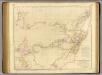
Australia.
1 : 2900000 Arrowsmith, John
Süd-Ost-Australien
Hand-Atlas über alle Theile der Erde und über das Weltgebäude Stieler, Adolf Justus Perthes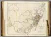
South Eastern Portion of Australia.
1 : 2534400 Arrowsmith, John
Süd-Ost-Australien
Adolf Stieler's Handatlas über alle Theile der Erde und über das Weltgebäude Stieler, Adolf Justus Perthes
Süd-Ost-Australien
Handatlas über alle Theile der Erde und über das Weltgebäude Stieler, Adolf Justus Perthes
Sud-Ost-Australien.
1 : 5000000 Petermann, A.
Map of the southern portion of South Australia
1 : 1000000 Jižní Austrálie Surveyor General's Office
South Australia.
1 : 2500000 John Bartholomew & Co.