Maps of Cairns
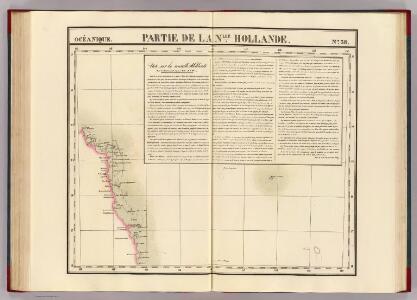
Partie, Nlle. Hollande. Oceanique no. 38.
1 : 1641836 Vandermaelen, Philippe, 1795-1869
Parish of Danbulla, county of Nares
1 : 32000 Queensland Survey Office, Dept. of Public Lands
Cook 2 mile map
1 : 130000 Survey Office, Dept. of Public Lands
Environs of Cairns
1 : 32000 Surveyor General's Office
Parish of Bellender Ker, County of Nares
1 : 32000 Cairns (Queensland : oblast) Survey Office, Dept. of Public Lands
Parish of East Barron, County of Nares
1 : 32000 Queensland Harrington, J. C. Survey Office, Dept. of Public Lands
Sketch map of portions 57 & 58 parish of Tinaroo, county of Nares
Survey Office, Department of Public Lands
Sketch map of Cape York peninsula
1 : 380000 Cape York (Queensland) Greenfield, W. H. Geological Survey Office, Department of Mines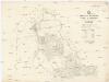
Parish of Herberton, county of Cardwell
1 : 32000 Queensland Costello, J. R. Survey Office, Dept. of Public Lands
Queensland, Australia. Coal Resources of the World.
1 : 4598000 Dunstan, B.
Map of Queensland
1 : 4030000 Queensland Outridge printing company
Queensland
1 : 6000000 Queensland Greenfield, W. H. Geological Survey Office, Department of Mines
Map of Queensland showing annual rainfall to end of 1899
1 : 3300000 Queensland Water supply department
Map of Queensland
1 : 2534400 Austrálie Water supply department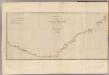
New South Wales.
1 : 4500000 Hawkesworth, John, 1715?-1773
Map of Queensland
1 : 3000000 Queensland Gordon & Gotch
Queensland.
1 : 4088064 Stanford, Edward
Map of Queensland showing annual rainfall to end of 1906
1 : 3200000 Queensland Water supply department
South Australia, New South Wales, Victoria & Queensland.
1 : 4919000 Johnston, Alexander Keith
S. Australia, N.S.W., Victoria, Queensland.
1 : 4919000 Johnston, Alexander Keith, 1804-1871
Australia (East)
1 : 5068800 Stanford, Edward
Eastern Portion of Australia.
1 : 5068800 Arrowsmith, John
Nieuw Guinea en omgeving
1 : 8000000 Annotatie: Vrijgegeven door W.B.N. 29-3 '44 Den Haag : Kompas
Cape Tribulation-Endeavour Straits.
1 : 2200000 Hawkesworth, John, 1715?-1773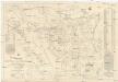
Sketch map of the Croydon & Etheridge goldfields
1 : 370000 Greenfield, W. H. Geological Survey Office, Department of Mines
Map of New South Wales.
1 : 12600000 Carey, Mathew
Map of New South Wales.
1 : 13000000 Carey, Mathew
Australia - eastern section.
1 : 6000000 John Bartholomew & Co.
Carte tres curieuse de la mer du Sud, contenant des remarques nouvelles et tres utiles non seulement...