Maps of Sandaun

Maps of Sandaun

$title$

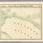
Partie, Nouvelle Guinee. Oceanique no. 23.

1 : 1641836 Vandermaelen, Philippe, 1795-1869
$title$

Aitape / U.S. Army Map Service

U.S. Army Map Service Washington D.C. Washington D.C. : U.S. Army Map Service
$title$

Bladwijzer van Eilanden Biak-Japen en Kuststrook Verkam-Hollandia

[S.l. : s.n.]
$title$

Languages of the Sepic Region, Papua New Guinea / D. Laycock

Australian National University Canberra [Canberra] : Australian National University
$title$

Bladwijzer van eilanden rondom Nieuw-Guinea

[S.l. : s.n.]
$title$

Wilhelmina-Top / Netherlands Topographic Service

Netherlands Topographic Service Delft [Delft] : Netherlands Topographic Service
$title$

Juliana-Gebergte / published by Survey Directorate H[ead] Q[uarters] SEALF [=South East Asia Land Forces]

Survey Directorate Head Quarters South East Asia Land Forces [S.l.] : Survey Directorate H[ead] Q[uarters] SEALF [=South East Asia Land Forces]
$title$

Wilhelmina-Top / Topografische Dienst

Topografische Dienst Batavia Batavia : Reproductiebedrijf Topografische Dienst
$title$

Meervlakte-West / prepared and reproduced by Base Map Plant USASOS SWPA, December 1942 - January 1943, from a Dutch map printed by Topografische Dienst (Topographic Service), Batavia 1941

Base Map Plant USASOS SWPA [S.l.] : Base Map Plant USASOS/SWPA
$title$

Meervlakte West / Netherlands Topographic Service

Netherlands Topographic Service Delft [Delft] : Netherlands Topographic Service
$title$

J.P. Coen-Gebergte / Survey Directorate H[ead] Q[uarters] ALFSEA [=American Land Forces South East Asia]

Survey Directorate Head Quarters American Land Forces South East Asia [S.l.] : Survey Directorate H[ead] Q[uarters] ALFSEA [=American Land Forces South East Asia]
$title$

J.P. Coen-Gebergte / Topografische Dienst

Topografische Dienst Batavia Batavia : Reproductiebedrijf Topografische Dienst
$title$

Juliana-Gebergte / Topografische Dienst

Topografische Dienst Batavia Batavia : Reproductiebedrijf Topografische Dienst
$title$

Rouffaer-Rivier / Netherlands Topographic Service

Netherlands Topographic Service Delft [Delft] : Netherlands Topographic Service
$title$

Rouffaer Rivier / Survey Directorate H[ead] Q[uarters] SEALF [=South East Asia Land Forces]

Survey Directorate Head Quarters South East Asia Land Forces [S.l.] : Survey Directorate H[ead] Q[uarters] SEALF [=South East Asia Land Forces]
$title$

Van Rees en Gauttier Gebergte / prepared and reproduced by Base Map Plant, December 1942 - January 1943, from Dutch map printed by Topografische Dienst (Topographic Service) Batavia, 1939

[Washington D.C.] : Base Map Plant USASOS, SWPA
$title$

[Aikimeugah-Rivier]

[S.l. : s.n.]
$title$

Van Rees en Gauttier Gebergte / Netherlands Topographic Service

Netherlands Topographic Service Delft [Delft] : Netherlands Topographic Service
$title$

De Mamberamo

$title$

Meervlakte-Oost / prepared and reproduced by Base Map Plant USASOS SWPA, December 1942 - January 1943, from a Dutch map printed by Topografische Dienst (Topographic Service), Batavia 1941

Base Map Plant USASOS/SWPA [S.l.] : Base Map Plant USASOS/SWPA
$title$

Übersichtskarte der Expeditionen nch Zentral-Neu-Guinea 1907 und 19090 unter der Leitung von Dr. H.A. Lorentz / aufgenommen und gezeichnet von J.W. van Nouhuys

[Leiden : Boekhandel en Drukkerij voorheen E.J. Brill]
$title$

Idenburg Rivier / prepared and reproduced by Base Map Plant USASOS/SWPA, December 1942 - January 1943, from a Dutch map printed by Topografische Dienst (Topographic Service), Batavia 1941

Base Map Plant USASOS SWPA [S.l.] : Base Map Plant USASOS/SWPA
$title$

Meervlakte Oost / Netherlands Topographic Service

Netherlands Topographic Service Delft [Delft] : Netherlands Topographic Service
$title$

Boven Digoel-Rivier / Topografische Dienst

Topografische Dienst Batavia Batavia : Reproductiebedrijf Topografische Dienst
$title$

Idenburg-Rivier / Netherlands Topographic Service

Netherlands Topographic Service Delft [Delft] : Netherlands Topographic Service
$title$

Carstensz-Toppen / Netherlands Topographic Service

Netherlands Topographic Service Delft [Delft] : Netherlands Topographic Service
$title$

Waropen Oost / Netherlands Topographic Service

Netherlands Topographic Service Delft [Delft] : Netherlands Topographic Service
$title$

Mamberamo Delta / prepared under the direction of the Chief Engineer by Base Map Plant U.S. Army, July 1944 ; published by Survey Directorate H[ead] Q[uarters] SEALF [=South East Asia Land Forces]

Survey Directorate Head Quarters South East Asia Land Forces (SEALF) [S.l.] : Survey Directorate H[ead] Q[uarters] SEALF [South East Asia Land Forces]
$title$

Waropen East / prepared under the direction of the Chief Engineer by Base Map Plant U.S. Army, Oct. 1944

Corps of Engineers U.S. Army War Department Washington D.C. [Washington D.C.] : Corps of Engineers U.S. Army, War Department
$title$

Biri Rivier / Survey Directorate H[ead] Q[uarters] ALFSEA [=American Land Forces South East Asia]

Survey Directorate Head Quarters American Land Forces South East Asia [S.l.] : Survey Directorate H[ead] Q[uarters] ALFSEA [=American Land Forces South East Asia]
© MapTiler © OpenStreetMap contributors
How does it work?
These instructions will show you how to find historical maps online.
Getting started
Type the place name in the search box to find the exact location. You can further adjust the search by zooming in and out.
Zoom
Zoom in and out with the buttons or use your mouse or touchpad natively.
Exact Area tool
Click here and draw a rectangle over the map to precisely define the search area.
Set filters
Narrow your search with advanced settings, such as Years (from/to), Fulltext, Publisher, etc.
Results
See the results of your search on the right side. You can scroll down to find more maps of this location.
?

Download OldMapsOnline Mobile