Maps of Bocaiuva

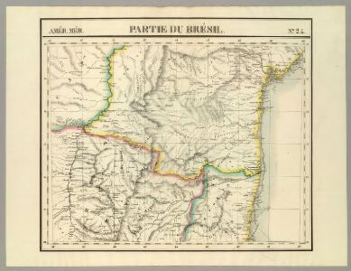
Partie du Bresil. Amer. Merid. 24.
1 : 1641836 Vandermaelen, Philippe, 1795-1869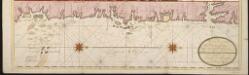
Een gedeelte van de kust van Brazilia tussen Rio das Contas en Cabo St. Thome [north part]
Brazil Gerard van Keulen
Een gedeelte van de kust van Brazilia tussen Rio Ponica en Rio das Contas
Brazil Gerard van Keulen
[Map of the All Saints' Bay, in the map:] BAHIA DE | TODOS OS SANC- | TOS
[Amsterdam : Joan Blaeu]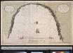
Afteekening van de Baij de Todelos Sanctos geleegen aen de cust van Brazilia met alle desselfs geleegentheden int groodt
Brazil Gerard van Keulen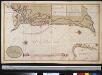
De Bahia de Todos los Santos met de stad St. Salvador in Brazilia neffens alle geleegentheeden van belegering der selver gedaan door sijn Ex.ti Johan Mourits van Nassau den 16 April 1639
Brazil Gerard van Keulen
229. Brazil, South East, Sao Paulo Region, Rio de Janeiro. The World Atlas.
1 : 3750000 USSR (Union of Soviet Socialist Republics).
De kust van Brazielia vertoonende de klippen van de Abreolhos int grood
Brazil Gerard van Keulen
Brazil - East - Central. Pergamon World Atlas.
1 : 5000000 Polish Army Topography Service
Novus Brasiliae Typus [Karte] [Baya de todos os Sanctos] [Nebenkarte], in: Novus Atlas, das ist, Weltbeschreibung, Bd. 2, S. 343.
1 Karte aus Atlas Blaeu, Joan Blaeu, Willem Janszoon
Maritima Brasiliae Universae
Blaeu, Joan [Blaeu]
Roteiro em Brazil no 1817-1821 do Dr. Pohl
1 : 16480000 Brazílie
Brasil du Sud.
1 : 6000000 Vivien St Martin, L.
S. Brazil, Paraguay, Uruguay.
1 : 6630000 Society for the Diffusion of Useful Knowledge (Great Britain)
South America 4.
1 : 2800000 Arrowsmith, Aaron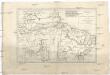
Brésil et pays des Amazones
1 : 10700000 Amazonka-oblast Bonne, Rigobert André
Eastern Brazil.
1 : 8400000 Sharpe, J.
[Süd-Amerika in 6 Blättern, Blatt 4]
Adolf Stieler's Handatlas über alle Theile der Erde und über das Weltgebäude Stieler, Adolf Justus Perthes
Accuratissima Brasiliae tabula
1 : 4000000 Henricus Hondius excudit Amstelodami : Henricus Hondius
Nova et accurata Brasiliae totius tabula
1 : 6000000 Blaeu, Joan, 1596-1673 Nunc apud Petrum Schenk Junior
South America 4.
1 : 6969600 Letts, Son & Co.
Paraquariae Provinciae.
1 : 5700000 Petroschi, Giovanni
Mapa geologico do estado de Minas Geraes
1 : 1000000 Guimarães, Djalma Belo-Horizonte : Imprensa Official
East Coast of South America. Brazil, Middle Provinces.
Fullarton, A. & Co.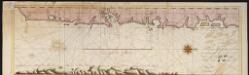
Een gedeelte van de kust van Brazilia tussen Rio das Contas en Cabo St. Thome [south part]
Brazil Gerard van Keulen
Accuratissima Brasiliae Tabula. [Karte] Baya de todos os Sanctos [Nebenkarte] Villa d'Olinda de Pernambuco [Nebenkarte], in: Gerardi Mercatoris et I. Hondii Newer Atlas, oder, Grosses Weltbuch, Bd. 2, S. 407.
1 Karte aus Atlas Mercator, Gerhard und Hondius, Jodocus Jansson, Jan
Novus Brasiliae Typus
Blaeu, Willem Janszoon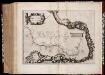
Maritima Brasiliæ universæ / [Joan Blaeu]
1 : 6375000 Annotatie: Kaart vertoont de plaatsen aan de westkust van Brazilië; Origineel is Blad 216 in atlas factice; Annotatie geografische gegevens: Schaalstokken op kaart: 60 Milliaria Germanica 15 uni gradui respondentia (=7,2 cm), en: 70 Milliaria Hispanica 17 1/2 gradui respondentia (=7,2 cm); West boven Joan Blaeu 1597/98-1673 [Amsterdam] : [Blaeu]
Nova et accurata Brasiliae totius tabula
1 : 6000000 Auctore Ioanne Blaeu I.F. [engraver: Johannes de Broen] [Amsterdam] : nunc apud Petrum Schenk Junior