Maps of Malanje

Maps of Malanje

$title$

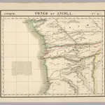
Congo et Angola. Afrique 41.

1 : 1641836 Vandermaelen, Philippe, 1795-1869
$title$

Carte de Angola: esboço / Ministerio das Colonias, Comissâo de Cartografia

1 Mapa. Ministerio das Colonias (Portugal). Comissâo de Cartografia
$title$

Provincia de Angola Porto do Ambriz à Baía dos Elefantes

1 : 750000 Hydrographic Map Instituto Hidrográfico Portugal Instituto Hidrográfico Portugal
$title$

Provincia de Angola Porto de Luanda à Ponta das Palmeiras

1 : 60000 Hydrographic Map Instituto Hidrográfico Portugal Instituto Hidrográfico Portugal
$title$

De baij en stadt Loand de St. Paulo geleegen aen de kust van Angola in Guinea

Angola Gerard van Keulen
$title$

Provincia de Angola Porto de Luanda

1 : 15000 Hydrographic Map Instituto Hidrográfico Portugal Instituto Hidrográfico Portugal
$title$

Provincia de Angola Enseada do Quicombo

1 : 15000 Hydrographic Map Instituto Hidrográfico Portugal Instituto Hidrográfico Portugal
$title$

Provincia de Angola Porto do Ambriz

1 : 10000 Hydrographic Map Instituto Hidrográfico Portugal Instituto Hidrográfico Portugal
$title$

Carta do Sul de Angola compreendendo a regiao situada ao sul do paralello 14\00BA

1 : 500000 Angola Ministerio das Colonias, Comissao de Cartografia
$title$

Carte internationale du monde au 1.000.000 E

1 : 1000000 Kinshasa (Kongo) Service géographique du Ministere des colonies
$title$

Afrika west coast

1 : 73000 Kongo (řeka) Medlycott, Mervyn Bradford Admirality
$title$

Afrika west coast

1 : 160000 Kongo (řeka) Vidal, R.N. Medlycott, Mervyn Bradford Admirality
$title$

REGNA | CONGO | et | ANGOLA.

[Amsterdam : Joan Blaeu]
$title$

Carte d'une partie de l'Afrique équinoxiale

1 : 3300000 Angola Brué, A. M. Jules Renouard
$title$

Map of a portion of South Africa : illustrative of Lieut. Cameron's route from lake Tangayika to the west coast

1 : 5000000 Ravenstein, Ernst Georg, 1834-1913 Geogr. Mag.
$title$

Spezial-Karte von Afrika

1 : 4000000 Blatt 7 Habenicht, Hermann Perthes
$title$

Western half of Equatorial Africa and the expeditions on land and sea by Henry M. Stanley during 1874-77

$title$

Carte du bassin du Congo

1 : 4000000 Kongo (Kinshasa) Kiepert, Richard Droysen, Wilhelm Dietrich Reimer
$title$

Regna Congo et Angola. [Karte], in: Novus atlas absolutissimus, Bd. 6, S. 180.

1 Karte aus Atlas Janssonius Offizin
$title$

Carte du Congo Belge

1 : 4000000 Belgie Falk fils
$title$

Charte von Nieder Guinea

Angola
$title$

CHARTE von NIEDER GUINEA

Angola
$title$

Nieder Guinea, W. Mittel-Africa.

1 : 5500000 Weiland, C. F. (Carl Ferdinand), d. 1847
$title$

Spezial - karte von AfricaSekt. Congo (7)

1 : 4000000 1 full d'1 mapa en 10 fulls i estoig Hermann Habenicht; Justus Perthes
$title$

Inner-Afrika und der Kongo-Staat

1 : 8000000 Afrika střední Kettler, I. J. Geographisches Institut
$title$

Congo Belge / comp. at the Royal Geographical Society under the dir. of the Geographical Section, General Staff ; drawn at the War Office

1 : 4000000 Royal Geographical Society, Verenigd Koninkrijk; General Staff, Verenigd Koninkrijk. Geographical Section; War Office, Verenigd Koninkrijk [S.l. : s.n.] / ([Bruxelles : I.C.M.])
$title$

Carte politique de l'Afrique centrale

1 : 10000000 Institut national de géographie. Belgique Bruxelles : Institut national de géographie
$title$

Croquis hydrographique de l'Afrique centrale

1 : 10000000 Institut national de géographie. Belgique Bruxelles : Institut national de géographie
$title$

Übersichtskarte zum Zuge der Emin Pascha - Entsatzexpedition quer durch Afrika

1 : 5800000 Afrika střední F.A. Brockhaus
$title$

Carte politique de l'Afrique centrale

1 : 10000000 Afrika střední Institut National de géographie
© MapTiler © OpenStreetMap contributors
How does it work?
These instructions will show you how to find historical maps online.
Getting started
Type the place name in the search box to find the exact location. You can further adjust the search by zooming in and out.
Zoom
Zoom in and out with the buttons or use your mouse or touchpad natively.
Exact Area tool
Click here and draw a rectangle over the map to precisely define the search area.
Set filters
Narrow your search with advanced settings, such as Years (from/to), Fulltext, Publisher, etc.
Results
See the results of your search on the right side. You can scroll down to find more maps of this location.
?

Download OldMapsOnline Mobile