Maps of Crystal Mountains

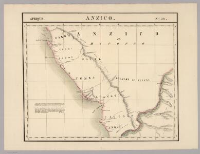
Anzico. Afrique 38.
1 : 1641836 Vandermaelen, Philippe, 1795-1869
Colonie du Gabon. Afrique Equatoriale Française
1 : 1000000 Meunier, A., cartographe Paris : Ministère des colonies
Croquis hypsométrique du Congo occidental
1 : 1000000 Kongo (Kinshasa) Delhaye, F. Sluys, M. E. Patesson
Région des cours supérieurs de l'Ogôoué, de l'Alima et de la Licona (Carte provisoire)
1 : 1000000 Brazza, Pierre Savorgnan de 1852-1905 Paris : Société de géographie
Karte des Handelsgebiets von West-Aequatoreal-Afrika
1 : 780000 L. Friedrichsen Hambourg : Friederichsen
Région du chemin de fer Congo-océan (esquisse topographique). Feuille 1 : Brazzaville-Kimbédi
1 : 250000 Lombard, Jean 1895-.... Paris : H. Barrère
Carte du bassin du Niari (Loudima-Comba)
1 : 250000 Lamy, François 1858-1900 Paris : Aron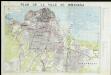
Plan de ville de Kinshasa
Afrika west coast
1 : 160000 Kongo (řeka) Vidal, R.N. Medlycott, Mervyn Bradford Admirality
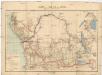
Afrique équatoriale Francaise
1 : 5000000 Afrika střední Barralier, Emmanuel Emile Larose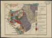
Carte géologique de l'Afrique équatoriale française. Planche sud
1 : 5000000 Loir, Erasme, géologue 18..-19.. Paris : Larose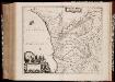
Regna Congo et Angola
1 : 3000000 Annotatie: Origineel is Blad 209 in atlas factice; Annotatie geografische gegevens: Schaalstok op kaart: 2 Milliaria Germanica Communia (=7,2 cm) [Amstelædami] : [Labore et Sumptibus Ioannis Blaev]
Afrique equatoriale Française
1 : 2000000 Kongo (Brazzaville) Meunier, A. Courtier
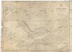
Cours du Congo entre le Pool et Bonga, rivières Alima et Nkeni
1 : 308333 Rouvier, Charles 18..-.... Paris : imp. Lemercier et Cie
Carte internationale du monde au 1.000.000 E
1 : 1000000 Kinshasa (Kongo) Service géographique du Ministere des colonies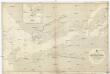
Afrika west coast
1 : 73000 Kongo (řeka) Medlycott, Mervyn Bradford Admirality
REGNA | CONGO | et | ANGOLA.
[Amsterdam : Joan Blaeu]
West Africa.
1 : 2500000 Andree, Richard; Times (London, England)
Central Africa - western section.
1 : 5000000 John Bartholomew and Son
Spezial-Karte von Afrika
1 : 4000000 Blatt 7 Habenicht, Hermann Perthes
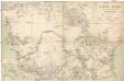
Western half of Equatorial Africa and the expeditions on land and sea by Henry M. Stanley during 1874-77
Carte du bassin du Congo
1 : 4000000 Kongo (Kinshasa) Kiepert, Richard Droysen, Wilhelm Dietrich Reimer
Regna Congo et Angola. [Karte], in: Novus atlas absolutissimus, Bd. 6, S. 180.
1 Karte aus Atlas Janssonius Offizin
Charte von Nieder Guinea
Angola
CHARTE von NIEDER GUINEA
Angola
Nieder Guinea, W. Mittel-Africa.
1 : 5500000 Weiland, C. F. (Carl Ferdinand), d. 1847
Spezial - karte von AfricaSekt. Congo (7)
1 : 4000000 1 full d'1 mapa en 10 fulls i estoig Hermann Habenicht; Justus Perthes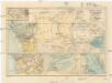
Central-Afrika mit dem internationalen Kongo-Gebiet
1 : 13000000 Afrika střední A. Hartleben
Inner-Afrika und der Kongo-Staat
1 : 8000000 Afrika střední Kettler, I. J. Geographisches Institut