Maps of Gold Coast

Maps of Gold Coast

$title$

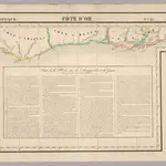
Cote d'Or. Afrique 35.

1 : 1641836 Vandermaelen, Philippe, 1795-1869
$title$

Carte des colonies de l'A.O.F. Bingerville

1 : 500000 Afrique occidentale française. Service géographique Paris : Henry Barrère
$title$

Een gedeelte van de kust van Gunea van Costa La Hon tot Cabo Trespuntas : vertoonende de kust van Adaows, Costa de Bonnegens ende Quaas kust

Ghana Gerard van Keulen
$title$

Een gedeelte van de kust van Gunea van C. das Palmas tot Costa La Hou vertoonende de kusten van Malegens en Grijn kust

Ivory Coast Gerard van Keulen
$title$

Carte des colonies de l'A.O.F. Tabou

1 : 500000 Afrique occidentale française. Service géographique Paris : Henry Barrère
$title$

Carte de la Côte d'Ivoire dressée par A. Meunier. Bingerville

1 : 500000 A. Meunier Paris : Service Géographique des Colonies
$title$

Carte de la Côte d'Ivoire dressée par A. Meunier. Sassandra

1 : 500000 A. Meunier Paris : Service Géographique des Colonies
$title$

Côte d'Ivoire [Tableau d'assemblage]

1 : 150000 Pobéguin, Henri 1856-1951 [Paris] : Ministère des Colonies
$title$

Special map of the inland countries on the Gold Coast up to Kumasi, an Anglo-African theater of war in 1874. By A. Petermann

$title$

Een gedeelte van de kust van Gunea van C. Corso tot Accara vertoonende 't Oostelijkste van de Goudkust int groot

Ghana Pieter Hinke Gerard van Keulen
$title$

Côte d'Ivoire. Cavally, Grabo

1 : 150000 Pobéguin, Henri 1856-1951 [Paris] : Ministère des Colonies
$title$

Een gedeelte van de kust van Gunea van C. Trespuntas tot C. Corso : vertoonende t Westelijkste van de Goutkust

Ghana Pieter Hinke Gerard van Keulen
$title$

Côte d'Ivoire. Cap des Palmes, Cavally

1 : 150000 Pobéguin, Henri 1856-1951 [Paris] : Ministère des Colonies
$title$

Gold Coast (1911)

[Africa. West Coast. Gold Coast. Achowa Point to Cape Coast Castle. Surveyed ... 1837]
$title$

Gold Coast (1920)

[Africa. West Coast. Gold Coast. Achowa Point to Cape Coast Castle. Surveyed ... 1837]
$title$

Côte d'Ivoire. Tabou, Béréby

1 : 150000 Pobéguin, Henri 1856-1951 [Paris] : Ministère des Colonies
$title$

Côte d'Ivoire. San Pedro, Drewin

1 : 150000 Pobéguin, Henri 1856-1951 [Paris] : Ministère des Colonies
$title$

Côte d'Ivoire. Sassandra, Fresco

1 : 150000 Pobéguin, Henri 1856-1951 [Paris] : Ministère des Colonies
$title$

Côte d'Ivoire. Haut-San Pedro, Kremoue

1 : 150000 Pobéguin, Henri 1856-1951 [Paris] : Ministère des Colonies
$title$

Côte d'Ivoire. Kouati, Doboue

1 : 150000 Pobéguin, Henri 1856-1951 [Paris] : Ministère des Colonies
$title$

Côte d'Ivoire. Haut-Sassandra, Daguire

1 : 150000 Pobéguin, Henri 1856-1951 [Paris] : Ministère des Colonies
$title$

Colonie de la Côte d'Ivoire. Grand Lahou. Lagune de Lahou et rivière Bandama

1 : 150000 Pobéguin, Henri 1856-1951 [Paris] :
$title$

Colonie de la Côte d'Ivoire. Tiassalé. Vallées des rivières Bandama et H'Zini

1 : 150000 Pobéguin, Henri 1856-1951 [Paris] :
$title$

Goald Coast Survey

Gold Coast Survey. Scale, 1 : 62,500. Accra : Gold Coast Survey Headquarters, etc.
$title$

The Gold Coast - Accra

$title$

Gold Coast Colony. Plan of Christiansborg

$title$

Accra / Reference No. X2270/159 / Sheet 159

$title$

Accra Harbour Works Improvements. Proposed Improvements shown in red

$title$

Siteplan of Basel Mission Factory Winnebah

$title$

Abokobi

© MapTiler © OpenStreetMap contributors
How does it work?
These instructions will show you how to find historical maps online.
Getting started
Type the place name in the search box to find the exact location. You can further adjust the search by zooming in and out.
Zoom
Zoom in and out with the buttons or use your mouse or touchpad natively.
Exact Area tool
Click here and draw a rectangle over the map to precisely define the search area.
Set filters
Narrow your search with advanced settings, such as Years (from/to), Fulltext, Publisher, etc.
Results
See the results of your search on the right side. You can scroll down to find more maps of this location.
?

Download OldMapsOnline Mobile