Maps of Tabuk Region

Maps of Tabuk Region

$title$

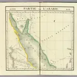
Partie, l'Arabie. Asie 77.

1 : 1641836 Vandermaelen, Philippe, 1795-1869
$title$

Karte von Nordwestarabien

1 : 800000 arabské země Moritz, B. Kgl. Preuss. Landesaufnahme
$title$

Red Sea (1917)

[The Red Sea, in five sheets. Sheet 1. Surveyed ... 1830-4. The Gulf of Suez and Coast to Kosaïr ... 1871-2. (Sherm Joobbah.--Sherm Yahar.--Tór Harbour)]
$title$

Internationale Weltkarte 1:1000 000

1 : 1000000 Medina (Saúdská Arábie) Generalstab des Heeres, Abteilung für Kriegskarten und Vermessungswesen
$title$

Geognostische Karte des peträischen Arabien und den südlichen Theiles von Sirien

1 : 880000 Sinajský poloostrov (Egypt) E. Schweizerbart'sche Buchhandlung
$title$

Carte de la presqu'ile de Sinai

1 : 1000000 Sinajský poloostrov (Egypt) Service géographique de l'Armée
$title$

Carte de l'Arabie pétrée

1 : 500000 levée et dressée par Léon de Laborde, en 1828 rectifiée sur les observations astronomiques et les cartes de Niebuhr, Larochette, la Commission d'Egypte, Home, Popham, Valentia, Burckhardt, Erhenberg et Rüppel, et gravée par Collin, pour accompagner le voyage de l'Arabie Petrée Paris : Giard
$title$

6 Vallee de Qosier.

1 : 100000 Jacotin, Pierre, 1765-1827
$title$

1 Cataractes, Syene.

1 : 100000 Jacotin, Pierre, 1765-1827
$title$

2 Koum Ommbous.

1 : 100000 Jacotin, Pierre, 1765-1827
$title$

3 Edfou.

1 : 100000 Jacotin, Pierre, 1765-1827
$title$

4 Esne.

1 : 100000 Jacotin, Pierre, 1765-1827
$title$

5 Thebes.

1 : 100000 Jacotin, Pierre, 1765-1827
$title$

8 El Haweh.

1 : 100000 Jacotin, Pierre, 1765-1827
$title$

Egypt 1:100 000

1 : 100000 Sinajský poloostrov (Egypt) Survey of Egypt
$title$

7 Qosier.

1 : 100000 Jacotin, Pierre, 1765-1827
$title$

22 Suez.

1 : 100000 Jacotin, Pierre, 1765-1827
$title$

Karte der westlichen Umgebung von Luksor und Karnak (Theben)

1 : 25000 Luxor (Egypt) Schweinfurth, Georg Dietrich Reimer
$title$

Luxor & Karnak

1 : 10000 Luxor (Egypt) Survey of Egypt
$title$

El Qurna

1 : 10000 Survey of Egypt
$title$

Red Sea [Harbours and anchorages in the ] (1919)

Harbours and Anchorages in the Red Sea. (Jezirat Farausa.--Strait of Tiran). London : Admiralty
$title$

Aswan and environs (Egypt) (1943)

Aswân and environs. Enlargement of 1:25,000 sheets. Egypt. Maṣlaḥat al-Misāḥah. [Cairo] : Survey of Egypt
$title$

Die südliche Galala mit dem nördlichen Theil der krystallinische Küstengebirge am Rothen Meer

1 : 200000 Schweinfurth, Georg Dietrich Reimer
$title$

[LL.05413gk], uit: [Palestina] / [Lukas Cranach d. Ä.]

1 : 850000 Annotatie: Onderste deel van de kaart; Van deze kaart is slechts 1 ander (eveneens incompleet) exemplaar bekend (Eran Laor Map Collection, Jeruzalem), waarbij juist het onderste deel van de kaart ontbreekt; Lit.: Cartographica Helvetica, 1991, H. 3, p. 22-27; Print quarterly, vol. 12, no. 2 (1995), p. 123-144 Cranach, Lukas (de Oudere) [Wittenberg : Lukas Cranach d. Ä.]
$title$

Geological map of the first or Aswan cataract

1 : 20000 Survey dept.
$title$

First or Aswan cataract

1 : 20000 Survey dept.
$title$

Die Wüstenregion zwischen Nil und Uadi Kenet

1 : 200000 Egypt Schweinfurth, Georg Geographische Verlagshandlung Dietrich Reimer
$title$

Die Wüstenregion zwischen Nil und Uadi Kenet

1 : 200000 Egypt Schweinfurth, Georg Geographische Verlagshandlung Dietrich Reimer
$title$

Plan de la partie septentrionale du golfe arabique et de la ville de Suès

1 Karte : Kupferdruck ; 18 x 29 cm Nyon
$title$

L'ancienne Thebaide ou les deserts d'Egypte habitez par les S.s Peres des deserts

1 : 3630000 Egypt Mortier, Pieter chez Pierre Mortier
© MapTiler © OpenStreetMap contributors
How does it work?
These instructions will show you how to find historical maps online.
Getting started
Type the place name in the search box to find the exact location. You can further adjust the search by zooming in and out.
Zoom
Zoom in and out with the buttons or use your mouse or touchpad natively.
Exact Area tool
Click here and draw a rectangle over the map to precisely define the search area.
Set filters
Narrow your search with advanced settings, such as Years (from/to), Fulltext, Publisher, etc.
Results
See the results of your search on the right side. You can scroll down to find more maps of this location.
?

Download OldMapsOnline Mobile