Maps of Götaland

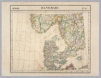
Danemarc. Europe 8.
1 : 1641836 Vandermaelen, Philippe, 1795-1869
Denmark.
from A system of geography, or, A new & accurate description of the earth in all its empires, kingdoms and states : illustrated with history and topography, and maps of every country : fairly engraven on copper, according to the latest discoveries and corrections / by Herman Moll.
Denmark, S. Norway.
1 : 1774080 Letts, Son & Co.
[Daenemark mit Schleswig, Holstein, und Lauenburg; Island u. Fär-Öer]
Schul-Atlas über alle Theile der Erde nach dem neuesten Zustande, und über das Weltgebäude Stieler, Adolf Justus Perthes
Danemark vizt Jutland, Zeland, Sleswick, Holstein.
from A new systeme of the mathematicks: containing I. Arithmetick, as well natural and decimal, as in species, or the principles of algebra. II. Practical geometry, together with the first six books of Euclid's Elements, as also the eleventh and twelfth, symbo
Denmark, pt. of Norway.
1 : 1770000 Society for the Diffusion of Useful Knowledge (Great Britain)
Postkarte von Schweden Ansich, von Gothland und von Norwegen
Gotland (Švédsko) Ponheimer, Kilian im von Reillyschen Landkarten und Kunstwerke Verschleiss Komptoir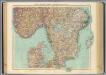
63-64. Svezia, Norvegia meridionale.
1 : 1500000 Touring club italiano
Denmark and part of Norway (Denmark, Norge)
1 : 2000000 Dánsko Walker, C. Baldwin & Cradock
[Dänemark, Island, die Far-Oer]
Plastischer Schul-Atlas über alle Theile der Erde : in 24 Karten Woldermann, G Verlag von P. Eckerlein
Spesielle kart 73: Dialektformers udbredelse i Kristianssands stift
1 : 2000000 A. B. Larsen Norges Geografiske Opmaaling
Carte réduite de la mer Baltique, 1
1 Blatt : 73 x 60 cm Froullé
Daniae Regni Typvs
1 : 2100000 Mollova mapová sbírka Ortelius, Abraham Diesthem, Aegidius Copenius
Daniæ, Frisiæ, Groningæ et Orientalis Frisiæ littora
1 Karte : Kupferdruck ; 48 x 56 cm Renard apud L. Renard
Daniae Regni Typus. [Karte], in: Theatrum orbis terrarum, S. 56.
1 Karte aus Atlas Ortelius, Abraham

Daenemark mit Schleswig, Holstein und Lauenburg auch Südl. Theil v. Schweden
Hand-Atlas über alle Theile der Erde nach dem neuesten Zustande und über das Weltgebäude Stieler, Adolf bei Justus Perthes
[Daenemark mit Schleswig, Holstein und Lauenburg auch Südl. Theil v. Schweden]
Hand-Atlas über alle Theile der Erde nach dem neuesten Zustande und über das Weltgebäude Stieler, Adolf bei Justus Perthes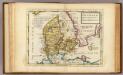
Denmark.
1 : 2700000 Moll, Herman, d. 1732
Denmark.
1 : 2400000 Bowen, Emanuel
Dania regnum in quo sunt ducatus Holsatia et Slesvicum insulae Danicae et provinciae Iutia Scania Blekingia et Hallandia
1 : 1100000 Dánsko Danckerts, Justus per I. Danckers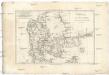
Royaume de Danemark
1 : 1740000 Dánsko Bonne, Rigobert André
[Daenemark mit Holstein und Lauenburg; auch Island und Fär-Öer]
Schul-Atlas über alle Theile der Erde nach dem neuesten Zustande, und über das Weltgebäude Stieler, Adolf bei Justus Perthes
Daniae Regnum [Karte], in: Gerardi Mercatoris Atlas, sive, Cosmographicae meditationes de fabrica mundi et fabricati figura, S. 140.
1 Karte aus Atlas Mercator, Gerhard Montanus, Petrus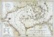
Carte de la mer de Dannemark et des entrées dans la mer baltique
1 Karte : Kupferdruck ; 59 x 85 cm s.n.
Daenemark
E. von Sydow's Schul-Atlas in sechs und dreissig Karten Sydow, Emil von bei Justus Perthes
Daenemark mit Holstein und Lauenburg auch südlicher Theil von Schweden
1 : 3200000 Dánsko

Atlas für Handel und Industrie: Für Kaufleute, Fabrikante u. Gewerbetreibende, Handlungs- u. Gewerbe-Schulen