Maps of Norrland

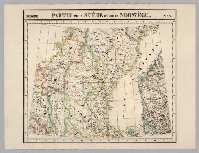
Partie, Suede, Norwege. Europe 4.
1 : 1641836 Vandermaelen, Philippe, 1795-1869
Trigonometrisk grunnlag, vedlegg 63a: Karta öfver Norra Sverige
1 : 500000 August Hahr Schlachter & Seedorff, Stockholm
NORDLANDIÆ | et quibies | GESTRICIA | et | HELSINGICÆ | REGIONES
Auct. Andrea Buræo Sueco. [Amsterdam : Joan Blaeu]

Nordlandiae et quibies Gestricia et Helsingicae regiones
1 : 1285000 auctore Andrea Buraeo Sueco [Amsterdam] : J. Blaeu
Norgesavdelingen 38c nord: Græntse-Carte imellom Norge og Swerrige
1 : 800000 Jens Christian Spidberg
Norgesavdelingen 209-4: Kart over det sydlige Norge
1 : 600000 Lars Østlin | Per Nissen | O. H. Paulsen H. Aschehoug og Co
Norgesavdelingen 227-4: Vægkart over Norge - sydlige blad
1 : 600000 P. Dybdahl | J. Sejersted A. Bruns Forlag
Norge 10: Kart over Trondhjems Len samt Dele af Jemteland og Herjedalen
1 : 400000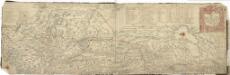
Norgesavdelingen 38a: Cart ofver Grentzerne imellum Norge og Swerig
1 : 800000 Jens Christian Spidberg
Island
Island Milbauer, Emanuel Vlastimil Walch, Johann
Karta öfver Swearike och norra delen af Swerige
1 : 720000 författad af C.P. Hällström S. Anderson sc. [Stockholm] : Geografiska Inrättningen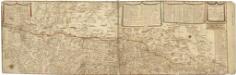
Norgesavdelingen 38b: Græntse Carte imellem Norge og Swerige
1 : 800000 Jens Christian Spidberg
Geologisk kart 5: Kart over Trondhjems stift.
1 : 400000 Theodor Kjerulf | K. M. Hauan
SUEONIA | Proprie sic dicta
Auctore Andrea Buræo. [Amsterdam : Joan Blaeu]
Norge 9: Kart over Trondhjems Stift
1 : 800000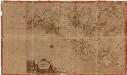
Norge 30: Præfectura Nidrosiensis Vulgo Trundheims Ampt
Melchior Ramus
Norge 160: Kart over det sydlige Norge
1 : 700000 B. Herders | P. A. Munch
Skogkart paa grunnlag av det Hydrografiske kart, blad 4
1 : 500000 Kaptein K. Gleditsch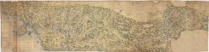
Norgesavdelingen 14: Kart over en Del af Trondhjems Stift
1 : 200000
Det nordöstlige blad
1 : 600000 Norsko severní H. Aschehoug
Le royaume Norvége
1 : 2400000 Norsko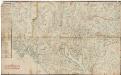
Kartblad 7 Carte over det 1. Trondhiemsche Regiment tillige med de 3 Nordenfi: Skieløber Compagniers Situation.
Isach Jørgen Coldevin
Spesielle kart nr 71: Oversigtskart udarbeidet som bilag til Lappekommissionens Indberetning
1 : 400000
Kartblad 75: Situationskart over det Første Throndhiemske Infanteriregiments District
Hendrich Christoffer Eckleff
Norge 55-2: Accurat landcaart over Norges Rige anden Part
1 : 300000 G. Bordin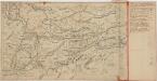
Kartblad 162: Scituvations Carte af Østerdalen
1 : 1000
Kartblad 47: Situations Carte over det Første Oplandske Herr Generalmajor de Reichaus Regiment med underliggende trende sønfieldske Skiløber Compagniers Districter
E. Einersen
Statistikk 38-9: Bosettingskart over Norge. Blad 9
Statistisk Sentralbyrå