Maps of Baluchistan

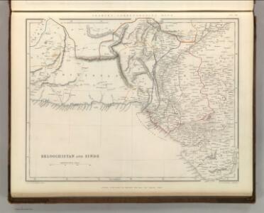
Beloochistan and Sinde.
1 : 3380000 Sharpe, J.
Beloutchistan. Asie 81.
1 : 1641836 Vandermaelen, Philippe, 1795-1869
India 5.
1 : 2217600 Letts, Son & Co.
India V.
1 : 2200000 Society for the Diffusion of Useful Knowledge (Great Britain)
Sind Survey, Sheet No 26
India Office reference collection of maps Survey of India
India. West Coast (1929)
[India. West Coast. Plans on the Kathiawar Coast. (Navibandar. Surveyed 1887.--Okha Port ... Surveyed ... 1922-23.--Porbander. Surveyed ... 1887)]
Anfa, qvibvsdam Anaffa
Casablanca (Maroko) Braun, Georg Hogenberg, Franz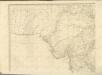
Karte von Europa und Westasien
1 : 4000000 Asie západní Ravensteins Geographische Verlagsanstalt und Druckerei
Tabula Asiae IX. [Karte], in: Geographia universalis vetus et nova complectens Claudii Ptolemaei Alexandrini enarrationis libros VIII, S. 290.
1 Karte aus Atlas Münster, Sebastian [und Ptolemaeus, Claudius]
Inde N.-O. et Afganistan.
1 : 5000000 Vivien St Martin, L.
Induslander.
1 : 4000000 Kiepert, Heinrich, 1818-1899
Bokhara, Cabool, Beloochistan &c
1 : 5000000 Asie střední Walker, C. Society for the diffusion of useful knowledge
Iran, Afganistan (1951)
Iran i Afganistan. Union of Soviet Socialist Republics. Glavnoe upravlenie geodezii i kartografii. Moskva : Glavnoe upravlenie geodezii i kartografii pri Sovete Ministrov SSSR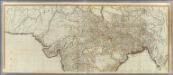
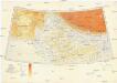
(Hindoostan north)
1 : 2500000 Robert Laurie & James Whittle
Cabool, The Punjab and Beloochistan.
1 : 6969600 Tallis, J. & F.
Punjab, Afghanistan
Tallis's Illustrated Atlas, and Modern History of the World, Geographical, Political, Commercial, and Statistical. Edited by R. Montgomery Martin. London : John Tallis and Co.
Bokhara, Cabool, Beloochistan &c.
1 : 4400000 Society for the Diffusion of Useful Knowledge (Great Britain)
Church Missionary Atlas: Part of the Bombay Presidency

Sheet A [North West India], uit: Road map of India
1 : 2027520 titelvariant: North West India; Central & North India; North East India; South India; Annotatie geografische gegevens: De bladen overlappen elkaar gedeeltelijk; Elk blad met bladoverzicht van de hele serie [S.l. : India Tyre & Rubber Company]
Bokhara, Cabool, Beloochistan & c
1 : 4300000 Balúčistán (Pákistán) Walker, John Walker, Alexander Society for the Diffusion of Useful Knowledge
Karte von Afghanistan und den angrenzenden Gebieten
1 : 500000 Afghánistán Petermann, August W. Nagel
Iran Östliche Hälfte enthaltend Afghanistan, Balutschistan und die Özbeghischen Khanate am Oxus
1 : 3000000 Afghánistán Kiepert, Heinrich Dietrich Reimer
Versuch einer Darstellung von Süd Jran [sic]
1 : 2200000 Balúčistán (Pákistán) Zimmermann, Carl Delius, Hermann D. Reimer
Der Sikh-Staat.
1 : 2200000 Flemming, Carl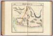
Beloutchistan. Asie 80.
1 : 1641836 Vandermaelen, Philippe, 1795-1869
India 12.
1 : 2217600 Letts, Son & Co.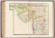
Guzerate, Chandeish et Aurungabad. Asie 93.
1 : 1641836 Vandermaelen, Philippe, 1795-1869
Panjab, Afghanistan, Kashmeer, Sinde &c.
1 : 2200000 Society for the Diffusion of Useful Knowledge (Great Britain)