Maps of Europe
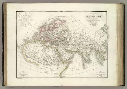
Carte du Monde connu des anciens.
1 : 26000000 Lapie, M. (Pierre), 1779-1850
Migrations des Peuples.
Andriveau-Goujon, J.
Monde ancien.
1 : 28000000 Andriveau-Goujon, J.
Bergketten In Asien Und Europa.
1 : 21000000 Berghaus, Heinrich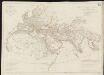
Orbis veteribus notus scilicet: Europe, Asia, Africa publici juris factus
1 : 19000000 Anville, Jean Baptiste Bourguignon d' Officina Adami Theophili Schneideri-Weigeliana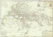
Orbis veteribus notus
1 : 17000000 Afrika Anville, Jean-Baptiste Bourguinon d' Delahaye, Guillaume-Nicolas D'Anville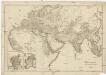
Orbis terarum veteribus notus
1 : 15650000 Afrika Reichard, Christian Gottlieb Campius, D. D. Campio
Die Volker Asien's Und Europa's.
1 : 30000000 Berghaus, Heinrich
North America. Pergamon World Atlas.
1 : 45000000 Polish Army Topography Service
[Die Völker Asien's und Europa's]
Zweiter Band, enthaltend in vier Abtheilungen die Vertheilung der Organismen: 5. Pflanzen-Geographie, 6. Thier-Geographie, 7. Anthropographie, 8. Ethnographie Humboldt, Alexander von Verlag von Justus Perthes
Bergketten in Asien und Eüropa / Potsdam, gez. u. gest. in der geogr. Kunstschule
1 : 28000000 1 Karte : Kupferdruck ; 32 x 43 cm Berghaus, Heinrich Karl Wilhelm J. Perthes
Orbis veteribus notus
Afrika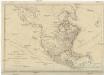
NORTH AMERICA, AS DIVIDED amongst THE EUROPEAN POWERS
Severní Amerika Dunn, Samuel
Stromgebiet, Nordamerica.
1 : 31000000 Radefeld, Carl Christian Franz, 1788-1874
[Bergketten in Asien und Europa]
Erster Band, enthaltend in vier Abtheilungen die Erscheinungen der anorganischen Natur: 1. Meteorologie und Klimatographie. 2. Hydrologie und Hydrographie. 3. Geologie. 4. Tellurischer Magnetismus Humboldt, Alexander von Verlag von Justus Perthes
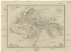
Asien
1 : 33633000 gezeichnet von H. Kiepert gestochen von W. Weiler Weimar : Geographisches Institut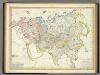
Asia-Europa; in Beziehung auf das Fliessende, und seine Vertheilung in Stromgebiete.
1 : 30000000 Berghaus, Heinrich
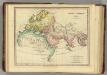
The World as Known to the Ancients.
1 : 39000000 Hughes, William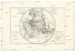
Mappe-monde sur un plan horisontal
Afrika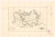
Calculus Eclipsis Solis Observatae die 19. Novemberis 1816
Die den Alten bekannte Erde
1 : 48910000 Afrika severní Leutemann
Asien
Terra Veteribus, Nota. (1826)
1 : 46000000 Tanner, Henry S.
[Asia-Europa; in Beziehung auf das Fliessende, und seine Vertheilung in Stromgebiete]
Erster Band, enthaltend in vier Abtheilungen die Erscheinungen der anorganischen Natur: 1. Meteorologie und Klimatographie. 2. Hydrologie und Hydrographie. 3. Geologie. 4. Tellurischer Magnetismus Humboldt, Alexander von Verlag von Justus Perthes
Orbis terrarum altero p. Chr. saeculo antiquis notus.
1 : 33000000 Kiepert, Heinrich, 1818-1899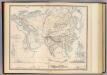
Physical Europe & Asia.
1 : 20000000 Johnston, Alexander Keith, 1804-1871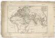
Orbis antiquus
1 : 85600000 Afrika Bonne, Rigobert André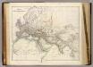
Orbis Veteribus Notus.
1 : 10000 Arrowsmith, John
Amerique du Nord spheroidale.
1 : 41000000 Garnier, F. A., 1803-1863