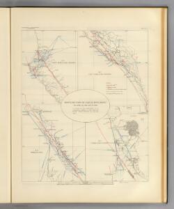
Maps of Point Arena

Maps of Point Arena

$title$

Distribution of earth movement, April 18, 1906 and 1868.

1 : 141000 California. State Earthquake Investigation Commission
$title$

Point Arena

1 : 62500
$title$

Point Arena

1 : 62500
$title$

Point Arena

1 : 62500
$title$

Point Arena

1 : 62500
$title$

Eureka Hill

1 : 24000
$title$

Point Arena

1 : 24000
$title$

Point Arena

1 : 24000
$title$

Point Arena

1 : 24000
$title$

Point Arena

1 : 24000
$title$

Point Arena

1 : 24000
$title$

Cold Spring

1 : 24000
$title$

Mallo Pass Creek

1 : 24000
$title$

Mallo Pass Creek

1 : 24000
$title$

Mallo Pass Creek

1 : 24000
$title$

Gualala

1 : 24000
$title$

Gualala

1 : 24000
$title$

Saunders Reef

1 : 24000
$title$

Saunders Reef

1 : 24000
$title$

Saunders Reef

1 : 24000
$title$

Gualala

1 : 24000
$title$

Gualala

1 : 24000
$title$

Gualala

1 : 24000
$title$

Navarro

1 : 62500
$title$

Navarro

1 : 62500
$title$

Saddle Point

1 : 62500
$title$

Navarro

1 : 62500
$title$

Navarro

1 : 62500
$title$

Navarro

1 : 62500
$title$

Coast of California showing San Andreas Rift.

1 : 140000 California. State Earthquake Investigation Commission
© MapTiler © OpenStreetMap contributors
How does it work?
These instructions will show you how to find historical maps online.
Getting started
Type the place name in the search box to find the exact location. You can further adjust the search by zooming in and out.
Zoom
Zoom in and out with the buttons or use your mouse or touchpad natively.
Exact Area tool
Click here and draw a rectangle over the map to precisely define the search area.
Set filters
Narrow your search with advanced settings, such as Years (from/to), Fulltext, Publisher, etc.
Results
See the results of your search on the right side. You can scroll down to find more maps of this location.
?

Download OldMapsOnline Mobile