Maps of Appalachian Mountains
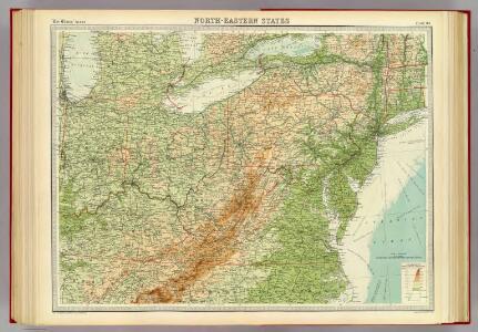
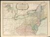
North-eastern states.
1 : 2500000 John Bartholomew & Co.
Copy of a map attached to Govr. Colden's History of the Five Indian Natio[ns] : printed in London, A.D. MDCCXLVII.
from Parts
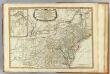
Pennsylvania and New Jersey.
from Parts
A map of the north west parts of the United States of America
1 : 3000000 Fitch, John, 1743-1798 engraved & printed by the author
Nieuwe en nauwkeurige kaart van een gedeelte van Noord Amerika : behelzende Nieuw Engeland, New York, Pennsylvania, New Jersey, Connecticut, Rhode Island, een stuk van Virginia, Kanada en Halifax, ter opheldering der reizen van den Heer P. Kalm / C.J. de
from Reis door Noord Amerika, gedaan door den Heer Pieter Kalm ... Vercierd met koperen platen ...
Vereinigte Staaten Von Nord-Amerika In 6 Blattern, Bl. 3.
1 : 3700000 Petermann, A.
Middle British colonies in America
from Parts
Nova tabula geographica complectens borealiorem Americae partem : in qua exacte delineatae sunt Canada sive Nova Francia, Nova Scotia, Nova Anglia, Novum Belgium, Pensylvania, Virginia, Carolina et Terra Nova : cum omnibus littorum pulvinorumque profundi
from John H. Levine Collection
[Die Vereinigten Staaten von Nord-Amerika, Blatt 3]
Handatlas über alle Theile der Erde und über das Weltgebäude Stieler, Adolf Justus Perthes
[Die Vereinigten Staaten von Amerika in 6 Blättern, Blatt 3]
Adolf Stieler's Handatlas über alle Theile der Erde und über das Weltgebäude Stieler, Adolf Justus Perthes
(West sheet) Map of the Provinces of Upper & Lower Canada with parts of the United States of America &c.
1 : 2300000 Faden, William, 1750?-1836
Bowles's new one-sheet map of the independent states of Virginia, Maryland, Delaware, Pensylvania, New Jersey, New York, Connecticut, Rhode Island, &c. : comprehending also the habitations & hunting countries of the confederate Indians.
from Bowles's universal atlas. ...
Distribution of the iron ores mined in the Lake Superior Region in year 1902
1 : 2500000 Birkinbine, John Geological Survey (U.S.)
New travelling and commercial map of the Canadas: from the Sault of St. Marie to the river Saguenay, and a large section of the United States of America / compiled from the latest surveys and most approved authorities ... by his obliged obedient humble servant David Taylor, R.N., March 1834; engraved by S. Stiles & Co.
from Parts David Taylor; S. Stiles & Co.,
Canada.
1 : 7300000 Lucas, Fielding Jr.
A new and general map of the middle dominions belonging to the United States of America: viz. Virginia, Maryland, the Delaware-counties, Pennsylvania, New Jersey &c. with the addition of New York, & of the greatest part of New England &c as also of the bordering parts of the British possessions in Canada.
from Parts Published by Laurie & Whittle, No. 53 Fleet Street ...: London; Robert Laurie and James Whittle,
An accurate map of Canada, with the adjacent countries: exhibiting the late seat of war between the English & French in those parts / R.W. Seale, del. et sculp.
from Canada R.W. Seale,
Map of the province of Ontario, dominion of Canada
1 : 2217600 Ontario Department of Lands, Forests & Mines, Bureau of Colonization
A new and general map of the middle dominions belonging to the United States of America, viz. Virginia, Maryland, the Delaware-counties, Pennsylvania, New Jersey &c. with the addition of New York & of the greatest part of New England
A Map of the British Empire in America. (Sheet 6).
1 : 2000000 Popple, Henry
Upper Canada &c.
1 : 2154240 Arrowsmith, John
Upper Canada.
1 : 2200000 Arrowsmith, John
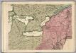
Ontario, Quebec.
1 : 2217600 Stanford, Edward
Vereinigte Staaten von Nord-Amerika in 6 blattern, bl. 3
Middle dominions U.S.
1 : 2200000 Robert Laurie & James Whittle
Carte pour servir à l'itinéraire pittoresque du fleuve Hudson et des parties latérales de l'Amerique du Nord
1 : 4200000 Milbert, Jacques Gérard Gaugain, Henri
A GENERAL MAP OF THE MIDDLE BRITISH COLONIES IN AMERICA
1 : 2000000 Delaware Pownall, Thomas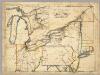
A New Map Of The Seat Of War.
1 : 2534400 Lewis, Samuel