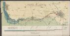
Maps of England

England.
1 : 1200000 Kiepert, Heinrich, 1818-1899
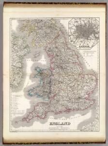
England and Wales.
1 : 2860000 Higgins, W.M.
Regnum Angliæ, sive pars australis Magnæ Britanniæ
1 Karte : Kupferdruck ; 47 x 58 cm Valck; Valck Gerard und Leonardus Valck
Anglia regnvm
1 Karte : Kupferdruck ; 37 x 48 cm s.n.
Anglia II. Nova Tabula [Karte], in: Geographia universalis vetus et nova complectens Claudii Ptolemaei Alexandrini enarrationis libros VIII, S. 305.
1 Karte aus Atlas Münster, Sebastian [und Ptolemaeus, Claudius]
Regni Angliæ et Walliæ principatus tabula
1 Karte : Kupferdruck ; 49 x 58 cm Gouwen; Tideman I. Covens et C. Mortier
Anglia regnvm
1 Karte : Kupferdruck ; 37 x 48 cm Janssonius apud Ioannem Ianssonium
Anglia regnvm
1 Karte : Kupferdruck ; 37 x 48 cm Blaeu Joan Blaeu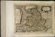
Angliæ regnum
1 Karte : Kupferdruck ; 17 x 24 cm Mercator Joannes van Cloppenburgh
Composite: England, Wales.
1 : 675000 Rocque, John
Angliae Regni Florentissimi Nova Descriptio [...] [Karte], in: Theatrum orbis terrarum, S. 36.
1 Karte aus Atlas Ortelius, Abraham
47-48. Inghilterra, Galles.
1 : 1500000 Touring club italiano
Britannia Antiqua.
1 : 2800000 Horsley, John, 1675-1732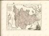

Le royaume d'Angleterre
1 Karte : Kupferdruck ; 39 x 49 cm Sanson; Fortin chéz Fortin ing.r mécanicien du roy pour les globes rue de la Harpe près la rue du Foin
A new and very accurate map of South Britain or England and Wales
1 Karte : Kupferdruck ; 33 x 40 cm Bowen; Kitchin s.n.
Le royaume d'Angleterre
1 Karte : Kupferdruck ; 38 x 49 cm Sanson chez l'autheur
Composite: England, Wales.
1 : 575000 Robert Laurie & James Whittle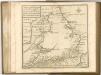

Charte von England
1 Karte : Kupferdruck ; 47 x 53 cm Stieler im Verlage des geographischen Instituts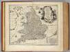
South Britain, or England and Wales.
1 : 2170000 Bowen, Emanuel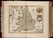
Anglia Regnum / [Joannes Janssonius]
1 : 1800000 Annotatie: Oorspr. verschenen in: Gerardi Mercatoris et I. Hondii Appendix Atlas ... - Amsterdam : bey Johan Jansson, 1636; Origineel is Blad 23 in atlas factice Janssonius, Joannes (jr.) (1588-1664) Amstelodami : apud Ioannem Ianssonium
An accurate map of England and Wales
1 Karte : Kupferdruck ; 58 x 49 cm Kitchin; Bowles; Bowles; Sayer; Tinney; Bowles printed for J. Tinney at the Golden Lion in Fleet Street T. Bowles in St. Pauls Church Yard John Bowles and son in Cornhil and Rob.t Sayer in Fleetstreet
The post roads thorough England and Wales
1 Karte : Kupferdruck ; 55 x 47 cm Jefferys; Dury printed for Andrew Dury in Dukes Court St Martin's Lane
Anglia Regnum [Karte], in: Novus Atlas, das ist, Weltbeschreibung, Bd. 3, S. 361.
1 Karte aus Atlas Blaeu, Joan Blaeu, Willem Janszoon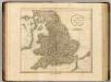
England.
1 : 1600000 Cary, John, ca. 1754-1835
Anglia Regnum [Karte], in: Gerardi Mercatoris et I. Hondii Newer Atlas, oder, Grosses Weltbuch, Bd. 1, S. 75.
1 Karte aus Atlas Mercator, Gerhard und Hondius, Jodocus Jansson, Jan
Anglia Regnum
1 : 1700000 Annotatie: Oorspr. verschenen in: Gerardi Mercatoris et I. Hondii Newer Atlas oder Grosses Weltbuch ... - Amsterdam : bey Johan Jansson, 1636 Amstelodami : apud Ioannem Ianssonium
Anglia regnum [Karte], in: Gerardi Mercatoris Atlas, sive, Cosmographicae meditationes de fabrica mundi et fabricati figura, S. 109.
1 Karte aus Atlas Mercator, Gerhard Montanus, Petrus