Maps of Africa

Africa, Atlantic.
1 : 50000000 Huntington, Nathaniel G. (Nathaniel Gilbert), 1785-1848
Florenkarte von Afrika und Australien
Atlas der Pflanzenverbreitung Drude, Oscar Justus Perthes
Africa.
1 : 33000000 Radefeld, Carl Christian Franz, 1788-1874
Ethnographische Karte von Afrika
Zweiter Band, enthaltend in vier Abtheilungen die Vertheilung der Organismen: 5. Pflanzen-Geographie, 6. Thier-Geographie, 7. Anthropographie, 8. Ethnographie Humboldt, Alexander von Verlag von Justus Perthes
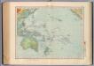
Oceanien.
1 : 42000000 Ziegler, J. M.
Africa
1 : 30000000 Calcografia Vignozzi Calcogafia Vignozzi
Afrika
Handatlas über alle Theile der Erde und über das Weltgebäude Stieler, Adolf Justus Perthes
Afrika
Hand-Atlas über alle Theile der Erde und über das Weltgebäude Stieler, Adolf Justus Perthes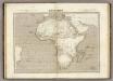
Afrique.
1 : 20000000 Montemont, A.
Afrika
Stieler's Hand-Atlas Stieler, Adolf bei Justus Perthes
(L'Afrique)
1 : 120000000 Bruyset, Jean-Marie; Schneider, J. H.
Afrika
Hand-Atlas über alle Theile der Erde nach dem neuesten Zustande und über das Weltgebäude Stieler, Adolf bei Justus Perthes
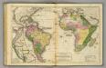
South America, Africa.
1 : 43000000 Woodbridge, William C.
Afrika
Hand-Atlas über alle Theile der Erde nach dem neuesten Zustande und über das Weltgebäude Stieler, Adolf bei Justus Perthes
Afrika
Geographischer Atlas über alle Theile der Erde Ziegler, Jakob Melchior Verlag von Dietrich Reimer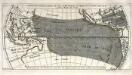
Répresentation du cours ordinaire des vents de traverse qui regnent sur les côtes dans la grande mer du Sud
1 Karte : Kupferdruck ; 15 x 30 cm Cosmant Didot
162-63. Oceania fisica.
1 : 30000000 Touring club italiano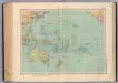
164-65. Oceania politica.
1 : 30000000 Touring club italiano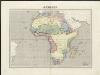
Afrique
1 : 20500000 dressée par C. V. Monin gravé sur acier par Laguillermie ; Jules Berthelemier script. Paris : Aubrée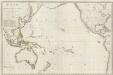
Composite: Oceanie.
1 : 15500000 Brue, Adrien Hubert, 1786-1832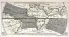
Réprésentation du cours ordinaire des vents de traverse qui regnent le long des côtes dans la mer Atlantique [et] celle des Indes
1 Karte : Kupferdruck ; 15 x 30 cm Cosmant Didot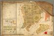
Mappa der zur k.k. Stadt Pilsner gehörigen und von der Hradecker abgetheilte = Bukssitzer
Rukopisná hospodářská mapa lesního revíru Švabiny a Lišky. Oba plány mají stejné měřítko. Značkami a barvou je vyznačen charakter a kvalita porostu. Jsou vyznačeny komunikace, hraniční kameny, 1 malá vodní plocha, 1 usedlo, jména sousedících panství. Vlevo nahoře tabulka s výměrou jednotlivých typů porostů na pozemcích, vlevo dole vysvětlivky značek, vpravo grafické a číselné měřítko v kompozici s neumělou alegorickou postavou.
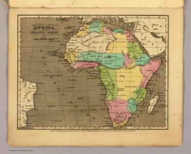
Africa.
1 : 46000000 Smiley, Thomas T.
Africa.
1 : 57000000 Adams, Daniel
Afrika

Africa.
1 : 65000000 Adams, Daniel
Africa
1 : 37000000 entw. u. gez. v. J. L. Grimm gest. v. Siebert Berlin : Schropp