Maps of South Sinai Governorate

Voyage des Israelites depuis leur sortie d'Egypte.
1 : 3000000 Houze, Antoine Philippe
Historický atlas revolučního hnutí
Egypte geog. 3.
1 : 1000000 France. Armee. Genie; Jacotin, Pierre, 1765-1827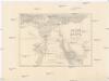
Dolní Egypt
1 : 1000000 Egypt Král z Dobré Vody, Vojtěch Fr. Šimáček
Biblische-Karte
Jeruzalém Růžička, Jan Hichmann, A.
Egypt.
1 : 1584000 Burr, David H., 1803-1875
Polostrov [sic] Sinajský s naznačeným pochodem Israelitův přes poušť k vydobytí země Kanaan
1 : 1900000 Izrael Uměl. závod Ed. Hölzela
Egypt.
1 : 1950000 Greenleaf, Jeremiah
Egypt.
1 : 1950000 Greenleaf, Jeremiah
Die Nilländer...

Afbeelding van Egypte, de woestyne der Schelfzee, en 't Land Kanaan : strekkende tot opheldering der bybelsche geschiedenis, dewelke begint van Jakobs vertrek naar Egypte, en eindigt met de verwinning van 't Land Kanaan
1 : 1400000 ontworpen door W.A. Bachiene J. van Jagen mapp. sculpsit, et figur. apposit. sculpturam curavit ; J.C. Philips fecit. te Gorinchem : by Nicolaas Goetzee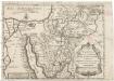
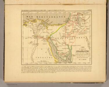
Tabula itineris, et stationum Israelitarum in deserto
1 : 950000 Palestina Starckman, P.
Mansionum populi Israelitici in deserto.
Sinajský poloostrov (Egypt) Grasmüller, E. Demeuse, Laurent
Synoptische tafel der H. Geschiedenis : van Mozes tot aan den tempel van Salomon (1491-1005 vóór Christus) / door H. Lambrecht
Annotatie: Hierop afgebeeld: Kaart voor de geschiedenis der reis van de Joden uit Egypte naar het land van belofte en hunner intrede in dat land. - Schaal: [1:3.000.000]. Palestina tusschen de 12 stammen verdeeld. - Schaal: [1:1.875.000] [S.l. : s.n.] / (Gent : Poelman)
Terra Promissionis
Sinajský poloostrov (Egypt) Dalrymple, Alexander Berra, Marco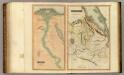
Egypt, Abyssinia.
Thomson, John
Geognostische Karte des peträischen Arabien und den südlichen Theiles von Sirien
1 : 880000 Sinajský poloostrov (Egypt) E. Schweizerbart'sche Buchhandlung
Carte de la presqu'ile de Sinai
1 : 1000000 Sinajský poloostrov (Egypt) Service géographique de l'Armée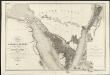
Carte de l'Arabie pétrée
1 : 500000 levée et dressée par Léon de Laborde, en 1828 rectifiée sur les observations astronomiques et les cartes de Niebuhr, Larochette, la Commission d'Egypte, Home, Popham, Valentia, Burckhardt, Erhenberg et Rüppel, et gravée par Collin, pour accompagner le voyage de l'Arabie Petrée Paris : Giard
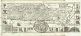
Aegypti Recentio Descriptio. [Karte], in: Theatrum orbis terrarum, S. 120.
1 Karte aus Atlas Ortelius, Abraham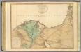
Lower Egypt, Palestine.
1 : 755000 Faden, William, 1750?-1836
Aegypti Recentior Descriptio. [Karte], in: Theatrum orbis terrarum, S. 311.
1 Karte aus Atlas Ortelius, Abraham
Egypt.
1 : 900000 Rand McNally and Company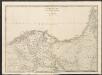
Lower Egypt
A new general atlas of modern geography, consisting of a complete collection of maps of the four quarters of the globe Wyld, James James Wyld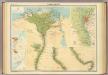
Lower Egypt.
1 : 1000000 John Bartholomew & Co.
[Ägypten] [Karte], in: Gerardi Mercatoris Atlas, sive, Cosmographicae meditationes de fabrica mundi et fabricati figura, S. 499.
1 Karte aus Atlas Mercator, Gerhard Montanus, Petrus
Kaart van de veertigjarige omzwerving der Israëliten in de woestijn van Arabië
1 : 2550000 S.I. Mulder del. steend. v. C. W. Mieling [Leyden] : D. du Mortier & Fil. excud.
Carte De L'Egypte et des Postes Militaires occupés et Fortifiés par les Français sous les ordres du Géneral en Chef Bounaparte, depuis leur invasion le 1. Juillet 1798, jusqu'à ce jour; Dressée d'après les relations fidelles des Chefs interceptées, et sur le compte qui en a eté rendu par les deserteurs
Kauffer, François
Das Nil-Delta und der Sues-Kanal
1 : 800000 Egypt Eduard Hölzel