Maps of Pittsfield
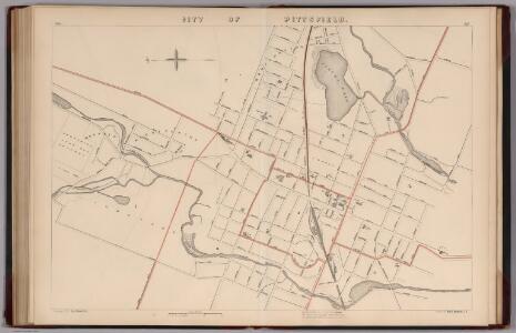
City of Pittsfield, Massachusetts.
1 : 6000 Walker, O.W.
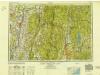
Becket quadrangle, Massachusetts
1 : 62500 Geological Survey (U.S.) U.S. Geological Survey
Pittsfield quadrangle, Massachusetts
1 : 62500 Geological Survey (U.S.) U.S. Geological Survey
Housatonic
1 : 125000
Housatonic
1 : 125000
Housatonic
1 : 125000
Housatonic
1 : 125000
Housatonic
1 : 125000
Housatonic
1 : 125000
New York
1 : 2000000 Breese, S.
Berkshire County.
1 : 158400 Gray, Ormando Willis; Walling, H. F.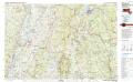
Pittsfield
1 : 100000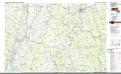
Pittsfield
1 : 100000
Columbia Co.
from Atlas of Columbia County, New York. From actual surveys and official records. Compiled & published by D. G. Beers & Co.
Map of the county of Berkshire, Massachusetts : based upon the trigonometrical survey of the state
1 : 50688 Walling, Henry Francis, 1825-1888 Smith, Gallup & Co.
Map of the counties of Albany and Schenectady / by David H. Burr; engd. by Rawdon, Clark & Co., Albany, & Rawdon, Wright & Co., New York.; An atlas of the state of New York: containing a map of the state and of the several counties / by David H. Burr.
from An atlas of the state of New York : containing a map of the state and of the several counties / by David H. Burr. Burr, David H.; Rawdon, Clark & Co.; Rawdon, Wright & Co.; Stone & Clark Republishers,
Plan of the encampment and position of the army under His Excelly. Lt. General Burgoyne at Swords House on Hudson's River near Stillwater on Septr. 17th : with the positions of that part of the army engaged on the 19th Septr. 1777 / drawn by W. C. Wilkin
from Revolutionary War
Map of the county of Columbia / by David H. Burr ; engd. by Rawdon, Clark & Co., Albany, & Rawdon, Wright & Co., New York.
from An atlas of the state of New York : containing a map of the state and of the several counties. / Projected and drawn under the superintendence and direction of Simeon de Witt ... And also the physical geography of the State ...
Map of the County of Rensselaer / by David H. Burr ; engd. by Rawdon, Clark & Co., Albany, & Rawdon, Wright & Co., New York.
from An atlas of the state of New York : containing a map of the state and of the several counties. / Projected and drawn under the superintendence and direction of Simeon de Witt ... And also the physical geography of the State ...
Railway and highway map of the famous Berkshire Hills region : showing also villages and points of interest : from official records and other information
1 : 134376 Watson, Walter, civil engineer Sun Printing Company
Railway and highway map of the famous Berkshire Hills region, showing also villages and points of interest : from official records and other information
1 : 134376 Watson, Walter, civil engineer Struthers, Servoss & Co.
Map of the county of Columbia / by David H. Burr; engd. by Rawdon, Clark & Co., Albany, & Rawdon, Wright & Co., New York.; An atlas of the state of New York: containing a map of the state and of the several counties / by David H. Burr.
from An atlas of the state of New York : containing a map of the state and of the several counties / by David H. Burr. Burr, David H.; Rawdon, Clark & Co.; Rawdon, Wright & Co.; Stone & Clark Republishers,
Map of the county of Columbia / by David H. Burr ; engd. by Rawdon, Clark & Co., Albany, & Rawdon, Wright & Co., New York.
from An atlas of the state of New York, designed for the use of engineers, containing a map of the state and of the several counties. / Projected and drawn ... under the superintendence and direction of Simeon de Witt.
Map of the county of Rensselaer / by David H. Burr ; engd. by Rawdon, Clark & Co., Albany, & Rawdon, Wright & Co., New York.
from An atlas of the state of New York, designed for the use of engineers, containing a map of the state and of the several counties. / Projected and drawn ... under the superintendence and direction of Simeon de Witt.
[Columbia County].
from New York Atlas.
Albany
1 : 250000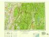
Albany
1 : 250000
Albany
1 : 250000
Albany
1 : 250000
Albany
1 : 250000