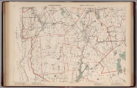
Maps of Massachusetts

Massachusetts. Atlas Plate No. 14.
1 : 63360 Walker, O.W.
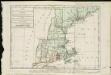
New England and New York in 1697
Carte de la Nouvelle Angleterre, comprenant les etats de Massachusets Bay, N. Hamp Shire, Connecticut et Rhode Island
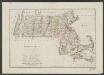
Massachusetts
1 : 490000 Sotzmann, D. F Bey Carl Ernst Bohn
To the honourable Walter Younge, barronet, one of the commissioners for his majestie's collonis : this description of New England in America is most humbly dedicated & presented by your hombl., faithfull & obedient servt
1 : 2200000 Hacke, William
Railroad Map Featuring Many Northeastern States Rhode Island Connecticut Massachusetts
1 : 2000
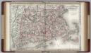
County map of Massachusetts, Connecticut, and Rhode Island.
from New general atlas.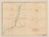
[Map of railroad lines from New York to Springfield, Mass.]
J.H. Bufford & Co Bufford & Co. Lith.
A map of the most inhabited part of New England containing the provinces of Massachusets Bay and New Hampshire with the colonies of Connecticut and Rhode Island divided into counties and townships the w[h]ole composed from actual surveys ...

A map of the most inhabited part of New England, containing the provinces of Massachusets Bay and New Hampshire, with the colonies of Connecticut and Rhode Island, divided into counties and townships, the whole composed from actual surveys ...

A map of the Province of New York, with part of Pensilvania, and New England.
from Charts and maps
New York (eastern section).
1 : 570000 Rand McNally and Company
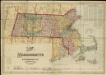
Massachusetts. Rhode Island.
1 : 789000 Gray, Ormando Willis
Massachusetts.
1 : 1900800 Scott, Joseph
Massachusetts

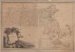
The state of Massachusetts from the best information

Massachusetts
Map of Massachusetts
Massachusetts, Connecticut and Rhode Island.
1 : 550000 Colton, G.W.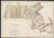
Massachusetts

Massachusetts.
1 : 1130000 Tanner, Henry S.
Massachusetts and Rhode Island, Vicinity of Boston.
1 : 850000 Colton, G.W.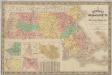
New map of Massachusetts : compiled from the latest and best authorities and corrected by permission from the survey ordered by the legislation in 1830, carefully revised and additions made in 1841
1 : 422400 Nathl. Dearborn
Colton's Massachusetts and Rhode Island
1 : 800000 G.W. & C.B. Colton & Co. G.W. & C.B. Colton & Co.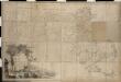
Map of Massachusetts proper compiled from actual surveys made by order of the General Court

Massachusetts.
1 : 696960 Carey, Mathew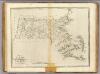
State of Massachusetts.
1 : 696960 Carey, Mathew
State of Massachusetts.
1 : 696960 Lewis, Samuel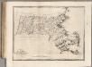
State of Massachusetts.
1 : 696960 Carey, Mathew