Maps of Washington, D.C.
Washington, Richmond.
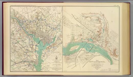
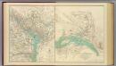
United States. War Dept. Engineer Bureau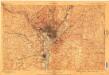
Washington
1 : 62500
Washington
1 : 62500
Territory of Columbia
Ellicott, Andrew, 1754-1820 s.n.
Topographical map of the original District of Columbia and environs showing the fortifications around the city of Washington
1 : 31680 Arnold, E. G G. Woolworth Colton
Shell Washington D.C. and Vicinity.
1 : 76032 Shell Oil Company
Washington & its vicinity
1 : 18100 J.H. Bufford's Lith.
Middleburg
1 : 50000
Fairfax
1 : 62500
Middleburg
1 : 62500
Fairfax
1 : 62500
Fairfax
1 : 62500
Fairfax
1 : 62500
Fairfax
1 : 62500
Maps of the Eastern, Middle and Southern States: Washington
Map of Washington. L. Prang & Co.
Strategic War Points of the United States no.4: city of Washington and District of Columbia
Strategic War Points of the United States no.4: city of Washington and District of Columbia J. Wyld
Strategic War Points of the United States no.4: city of Washington and District of Columbia
Strategic War points of the United States no.4: city of Washington and District of Columbia J. Wyld
Topographical map of the District of Columbia and a portion of Virginia
1 : 15840 Greene, F. V. (Francis Vinton), 1850-1921 [s.n.]
District of Columbia
1 : 120000 Bradford, Thomas G.
Spot map showing residences of juvenile delinquents in the District of Columbia as of July 1, 1935
1 : 19200 [s.n.]
Base map of the District of Columbia showing railroads, main thoroughfares, alley blocks, and public (government) buildings
1 : 19000 District of Columbia. Office of the Surveyor [s.n.]
Base map of the District of Columbia showing public and zoning areas
1 : 19200 District of Columbia. Office of the Surveyor Engineer Commissioner
Defenses Washington.
1 : 47520 Whiting, H. L.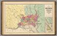
Map of the District of Columbia, Washington, Georgetown, and Alexandria.
1 : 31680 Walling, H. F.
Plan of the city of Washington.
from Charts and maps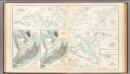
1st Corps Army of Virginia; Secessionville; Grand Lake Region.
United States. War Department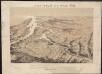
Bird's eye view of part of Maryland, Distr of Columbia and part of Virginia
Bachmann, John Rumpf, A.
Plan of the city of Washington.
from Washington, D.C.
Plan of the city of Washington, in the territory of Columbia, ceded by the States of Virginia and Maryland to the United States of America, and by them established as the seat of their government after the year 1800
1 : 19800 Russell, John