Maps of Loudoun County
N.E. Virginia, Washington 1.
1 : 126720 Young, J. J.
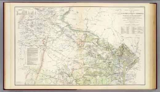
Map Of N. Eastern Virginia And Vicinity Of Washington
1 : 63360 U.S. War Department, Topographical Engineers
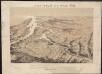
Map of the Battle Ground, showing 5 mile distances from Washington
Map of the Battle Ground, showing 5 mile distances from Washington L. Prang & Co.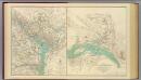
Washington, Richmond.
United States. War Dept. Engineer Bureau
Territory of Columbia
Ellicott, Andrew, 1754-1820 s.n.
Geographical, statistical, and historical map of the District of Columbia / engraved by Young & Delleker.
from Charts and maps
[Map of Poolesville, Maryland and vicinity showing the position of Union brigades]
Stoneman, George, 1822-1894
Shell Washington D.C. and Vicinity.
1 : 76032 Shell Oil Company
Washington & its vicinity
1 : 18100 J.H. Bufford's Lith.
Middleburg
1 : 50000
Fairfax
1 : 62500
Middleburg
1 : 62500
Fairfax
1 : 62500
Fairfax
1 : 62500
Fairfax
1 : 62500
Fairfax
1 : 62500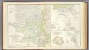
Defenses Washington.
1 : 47520 Whiting, H. L.
Strategic War Points of the United States no.4: city of Washington and District of Columbia
Strategic War points of the United States no.4: city of Washington and District of Columbia J. Wyld
District of Columbia
1 : 120000 Bradford, Thomas G.
Strategic War Points of the United States no.4: city of Washington and District of Columbia
Strategic War Points of the United States no.4: city of Washington and District of Columbia J. Wyld
Maps of the Eastern, Middle and Southern States: Washington
Map of Washington. L. Prang & Co.
Topographical map of the District of Columbia and a portion of Virginia
1 : 15840 Greene, F. V. (Francis Vinton), 1850-1921 [s.n.]
Base map of the District of Columbia showing railroads, main thoroughfares, alley blocks, and public (government) buildings
1 : 19000 District of Columbia. Office of the Surveyor [s.n.]
Spot map showing residences of juvenile delinquents in the District of Columbia as of July 1, 1935
1 : 19200 [s.n.]
Base map of the District of Columbia showing public and zoning areas
1 : 19200 District of Columbia. Office of the Surveyor Engineer Commissioner
Topographical map of the original District of Columbia and environs showing the fortifications around the city of Washington
1 : 31680 Arnold, E. G G. Woolworth Colton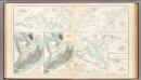
1st Corps Army of Virginia; Secessionville; Grand Lake Region.
United States. War Department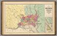
Map of the District of Columbia, Washington, Georgetown, and Alexandria.
1 : 31680 Walling, H. F.
Plan of the city of Washington.
from Charts and maps