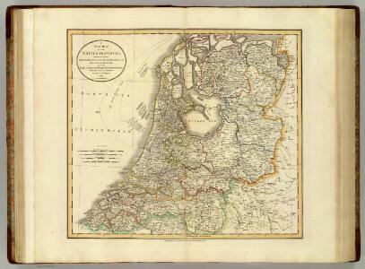
Maps of Netherlands
United Provinces.
1 : 590000 Cary, John, ca. 1754-1835
Belgium foederatum
1 : 625000 Maastricht (Nizozemsko) Visscher, Nicolaes Jansz. Schenk, Pieter P. Schenk iunior
Belgium foederatum
1 : 625000 Maastricht (Nizozemsko) Visscher, Nicolaes Jansz. par Nicolaum Visscher
Belgium foederatum
1 : 630000 Belgie Visscher, Nicolaus per Nicolaum Visscher

Carte des sept provinces unies des Pays-Bas connues sous le nom général de Hollande
1 : 700000 dressée par Hérisson ... A Paris : chez Basset
Karte von der Republik der vereinigten Niederlande
1 : 470000 Nizozemsko Reilly, Franz Johann Josef von Stöber, Joseph Franz Joh. Jos. von Reilly
Holland (Netherlands).
1 : 1270000 Higgins, W.M.
Foederatae Belgicae tabvla
1 : 728000 Limburg (Belgie) Wit, Frederick de F. de Wit
Belgium foederatum / emendatius auctum et novissimé editum per Iustinum Danckerts Amstelodami
1 : 500000 Annotatie: Cum privil. Ordin. Holl. et Westfrisiae; Annotatie geografische gegevens: Met 2 schaalstokken Justus Danckertsz 1635-1701 [Amsterdam : Justus Danckerts]
Belgica Foederata complectens septem Provincias,
1 : 610000 Mollova mapová sbírka Valk, Gerhard Valck, Gerard
Provinces Vnies de Pays Bas
1 : 861000 Nizozemsko
Belgica Foederata
1 : 610000 Mollova mapová sbírka Lotter, Tobias Conrad Lotter, Tobias Conrad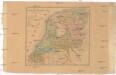
Die vereinigten Niederlande
Nizozemsko Sotzmann, Daniel Friedrich Franz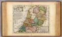
The United Provinces or Netherlands and Arx Britannica.
1 : 1450000 Moll, Herman, d. 1732
Provincie Vnite De Paesi Bassi
1 : 780000 Mollova mapová sbírka Sanson, Nicolas De Rossi, Giovanni Giacomo
Nieuwe kaart van het Koningrijk Holland verdeeld in X Departementen.
1 : 570000 Te Amsterdam : bij Mortier Covens en Zoon
Carte nouvelle des Provinces Unies des Pais Bas dressée suivant les dernières observations = Nieuwe kaart van de VII Provintien naar de nieuwste waarneemingen.
1 : 580000 Te Amsterdam : bij I. Covens & Zoon
5me [Driehoeksnet], uit: Nouvelle carte de la Hollande, d'après Kraijenhoff et les meilleures cartes connues / Établissement Géographique de Bruxelles, fondé par Ph. Vander Maelen
1 : 117000 Annotatie: De bladen zijn genummerd 1-24. De bladen 2 t/m 24 hebben elk een afzonderlijke titel. Blad 5 bevat: Triangulations et positions. Blad 9 bevat: Plan d'Amsterdam; De kaartbladen 1, 5, 9 en 24 zijn niet ingekleurd; Van kaartblad 24 is een extra (ingekleurd) exempl. aanwezig; Annotatie geografische gegevens: 2 schaalstokken: 5 Echelle de 5 lieues de 20 au degré ... (= 23,2 cm) en 7380 Echelle de 5 lieues de 20 au degré ... (= 23,2 cm); Legenda; Met indexkaart: Carte d'assemblage Philippe Marie Guillaume Vander Maelen 1795-1869; Établissement Géographique de Bruxelles Bruxelles : Établissement Géographique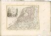

Holland.
1 : 1300000 Finley, Anthony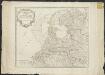
Les Provinces-Unies des Pays-Bas que comprennent le duché de Gueldre, les comtés de Hollande, de Zelande, de Zutphen, les Seigneuries d'Utrecht, d'Ouest-Frise, d'Ower-Issel et de Groningue
1 : 600000 par le Sr. Robert [gravé par] Haussard. [Paris] : [Robert]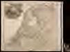
Belgium foederatum
1 : 630000 1 Karte : Kupferdruck ; 49 x 55 cm Danckerts, Justus [Danckerts]
Belgium Foederatum auctius et emendatius
1 : 780000 Mollova mapová sbírka Seutter, Matthäus Lotter, Tobias Conrad Seutter, Matthäus
Les Provinces Unies ou la Partie Septentrionale des Pays Bas
1 : 780000 Mollova mapová sbírka Coronelli, Vincenzo Maria Loon, Herman van Nolin, Jean Baptist François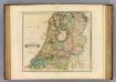
Netherlands.
1 : 690000 Lizars, Daniel
Nieuwe kaart der Vereenigde Nederlanden
1 : 900000 Amsterdam : by Isaak Tirion
Belgium foederatum
1 : 640000 Indonésie Seutter, Matthäus studio [Mattha]ei Seutteri