Project
Community
News
My maps
Mapa catalogado
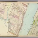
3 Bergen Co., N.J.
Título completo:
3 Bergen Co., N.J.
Editora:
Watson & Co.
Escala do mapa:
1:14 400
História