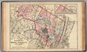
Maps of Passaic County
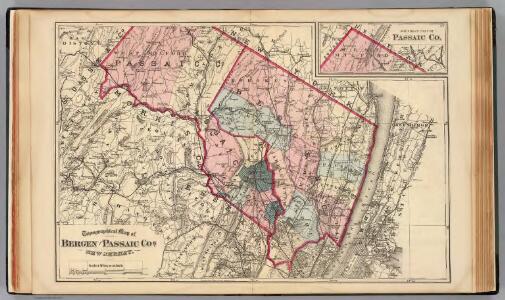
Bergen, Passaic Cos., N.J.
1 : 126720 Beers, F. W. (Frederick W.)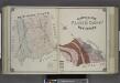
Geological Map of Passaic County, New Jersey.
from Atlas of Passaic County, New-Jersey : topographical, geological, historical, illustrated ; from actual surveys of each township and village / under the supervision of the publishers, assisted by the able engineers of Paterson.
New Jersey, Double Page Sheet No. 7 [Map of Northeastern Red Sandstone]
From Atlas of New Jersey.
7 NE red sandstone.
1 : 63360 Vermeule, C. C. (Cornelius Clarkson), 1858-1950
Watson's new map of the city of Brooklyn including Brooklyn
From Brooklyn
Paterson, N.J. - N.Y., ed. of Feb. 1903, repr. 1924
from New Jersey, 15 minute series (topographic) / mapped, edited, and published by the Geological Survey.
General map of the city of New York, consisting of boroughs of Manhattan, Brooklyn, Bronx, Queens and Richmond : consolidated into one municipality by act of the legislature of the state of New York (Chapter 378 of the laws of 1897) : showing in addition
from Whole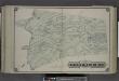
Township of West Milford [Township]
from Atlas of Passaic County, New-Jersey : topographical, geological, historical, illustrated ; from actual surveys of each township and village / under the supervision of the publishers, assisted by the able engineers of Paterson.
Morristown
1 : 62500
Morristown
1 : 62500
Morristown
1 : 62500
Morristown
1 : 62500
Morristown
1 : 62500
Paterson
1 : 62500
Paterson
1 : 62500
Paterson
1 : 62500
Paterson
1 : 62500
Paterson
1 : 62500
Paterson
1 : 62500
Paterson
1 : 62500
Paterson
1 : 62500
Paterson
1 : 62500
Morristown
1 : 62500
Morristown
1 : 62500
Paterson
1 : 62500
Morristown
1 : 62500
Morristown
1 : 62500
Paterson
1 : 62500
Map of the Hudson ... from Spuyten Duyvil to P. Livingston's.
from Map of the Hudson between Sandy Hook & Sandy Hill : with the post road between New York and Albany / Bridges delt. ; Rollinson sct.