Maps of Península Ibérica

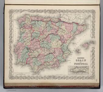
Spain and Portugal.
1 : 3200000 Colton, G.W.
Espagne et Portugal.
1 : 3250000 Malte-Brun, Conrad, 1775-1826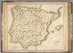
Hispania.
1 : 2150000 Playfair, Principal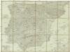
Carte d'Espagne et de Portugal en neuf feuilles
1 : 1000000 Gibraltar Mentelle, Edme Chanlaire, P. G. E. Mentelle et P.G. Chanlaire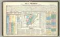
Tableau l'historie de l'Espagne.
1 : 6600000 Duval, Henri
Hispania
1 : 1270000 Portugalsko Reichard, Christian Gottlieb Campius, D. a D. Campio
Portugal und Spanien
Schul-Atlas in 36 Karten Völter, Daniel Verlag der J.M. Dannheimer'schen Buchhandlung
Espagne, Portugal.
1 : 3000000 Levasseur, E.
Spain and Portugal.
1 : 3250000 Colton, G.W.
Spain, Portugal.
1 : 4500000 Tanner, Henry S.
Spain and Portugal.
1 : 3200000 Colton, G.W.
Spain & Portugal.
1 : 1900800 Stanford, Edward
Spain & Portugal.
1 : 2450000 Hughes, William
Charte der Piraeneischen Halbinsel oder der Königreiche Spanien und Portugal
Hispania Antiqua. (1826)
1 : 4400000 Tanner, Henry S.
Spain and Portugal.
1 : 2930000 Rand McNally and Company
Spain and Portugal.
1 : 2150000 Playfair, Principal
Spain and Portugal.
1 : 3279000 Colton, G. Woolworth
Mapa de Espana
1 : 2000000 Kanárské ostrovy Instituto geográfico
Espagne Ancienne.
1 : 3815000 Levasseur, E.
Spain & Portugal.
1 : 4300000 Finley, Anthony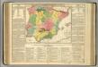
Spain and Portugal.
1 : 3400000 Lavoisne, M.
Spain and Portugal.
1 : 4000000 Colton, G.W.
Spain and Portugal. Pergamon World Atlas.
Polish Army Topography Service
Composite: Spanien, Portugal.
1 : 1800000 Theinert, A.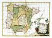
Li regni di Spagna e Portogallo
1 Karte : Kupferdruck ; 28 x 40 cm Zatta presso Antonio Zatta
Typvs Hispaniæ
1 Karte : Kupferdruck ; 35 x 48 cm Janssonius; Gerritsz ex officina ære et sumptibus Ioannis Ianssonii
Regnorvm Hispaniæ nova descriptio
1 Karte : Kupferdruck ; 36 x 48 cm Blaeu apud Guiljelmum Blaeuw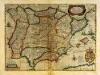
Typvs Hispaniæ
1 Karte : Kupferdruck ; 35 x 48 cm Mercator; Hondius; Gerritsz ex officina ære et sumptibus Henrici Hondij F